Um dos efeitos esperados como consequência das alterações climáticas é a erosão costeira. Portugal deve ser particularmente afetado pelo aumento de temperatura no futuro. Segundo o último relatório do Painel Intergovernamental para as Alterações Climáticas o pior cenário prevê um aumento de até 9°Celsius no verão até 2100.
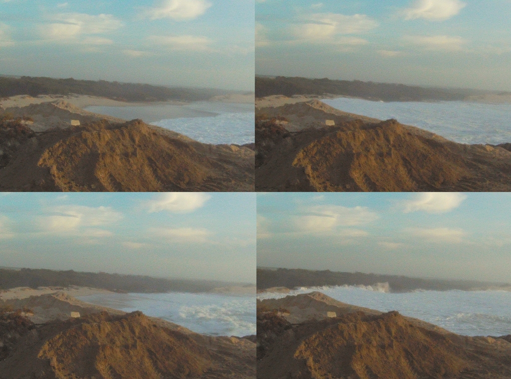
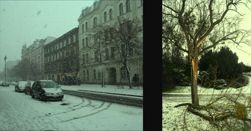
Figura 1. Zonas das dunas sendo destruída por ondas em quatro momentos subsequentes (Foto: Rodrigo Ribeiro, 2011).
A imagem acima mostra a destruição de dunas das Gafanhas em Aveiro provocado por ondas em uma das marés. Todos nós nos podemos observar o fenômeno das mares junto à costa, ocorrem quase sempre duas vezes ao dia e com relação ao ciclo lunar, ocorre devido a força gravitacional de atração exercida pelo Sol e pela Lua nas águas dos oceanos e também nos continentes. Um dos tipos de marés são as marés vivas, quando a amplitude da maré pode atingir até 3 metros segundo o Instituto Geográfico de Portugal.
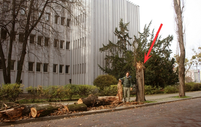
Os grandes volumes de areias extraídos dos sistemas fluviais e das zonas portuárias nas últimas décadas conduziram um déficit sedimentar generalizado que se manifesta ao longo de grande parte da costa Portuguesa. Essas barreiras de proteção que foram construídas com uma altura média de 8 metros e 120 metros comprimentos segundo um estudo publicado na Revista de Gestão Costeira. A imagem abaixo mostra o acúmulo de areia na parte superior do espigão de proteção e as dunas destruídas por ondas em 2011.
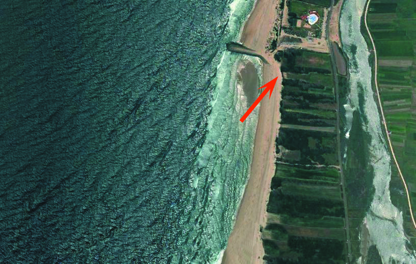
Fig.2 Localização das dunas destruidas.
Essas zonas de proteção próximas aos quebra-mares apresentam fragilidades e em situações de mares vivas ou tempestades quando é mais provável ocorrer e destruição dessas dunas, como foi presenciado pelo autor em um trabalho de campo em Outubro de 2011 na zona das Gafanhas no distrito de Aveiro em que as ondas destruíram as dunas de proteção e a estrada, além de inundar e introduzindo água salgada na região.
As ondas de altura significante destruíram as dunas e mostraram sua força, lembrando que é preciso manter a guarda com relação aos desastres naturais e estudar mais os efeitos de obras de proteção junto às costa. A questão das alterações climáticas merecerá uma atenção redobrada para as áreas costeiras, em ações que ajudem a sociedade a adaptarem a um futuro mais quente.
Video feito no local junto com o Engenheiro e Ambientalista Marco Passarelli:
http://www.youtube.com/watch?v=vFhXh9yyEgc&feature=youtu.be
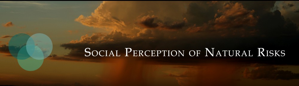
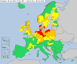
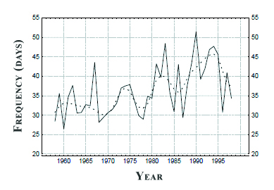
 Accurate knowledge of the frequency distribution of strong surface wind is of major relevance for insurance related risks in Europe. The risk of wind it a kind of not so a popular risk that people are very afraid. As financial losses due to weather extremes escalate, in the development of information related with of wind storm over Europe. The series of number of strong winds shows that in the last 40 years is accompanied by an increase in year-to-year of this phenomenon.