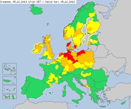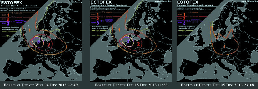
Forecast for extreme weather in Europe.
A developing extra tropical low pressure system over the North Atlantic, dubbed “Xaver”, is predicted to very strong into a potent storm with winds near hurricane force. The storm Xaver struck northern Europe on Thursday night with speed winds of 200km/h. It affected several people and causing flooding, damage and transport disruption across Poland, Germany, the Netherlands and southern Sweden.

The combination of many factors as strong winds, cold air from Greenland and high tide of the sea putted in a more severe position the recent storm. The video below shows the the beginning of the storm in Toruń, Poland:
http://www.youtube.com/watch?v=_5j58Ae8giU&feature=youtu.be
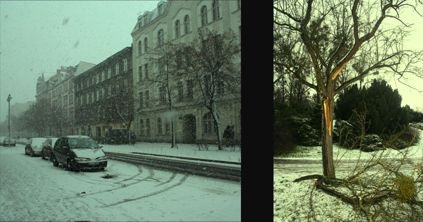
The risk of storms come again to Europe, people in the affected areas are advised to remain indoors wherever possible and to take extra caution if going outdoors cannot be avoided. Continuing height falls across central and Eastern Europe on the one hand and increasing geopotential across the northern Atlantic result in a west-north-westerly flow over most of Europe on Thursday morning. A strong winter storm with intense cold air addiction was ll be dominant in the storm. Across southern Europe, subsidence is expected through-out the forecast period. The pictures below shows some impacts in Toruń in Poland.

Storm at the city of Toruń, Poland.
The predicted surface winds of the storm Xaver was similar to the ones the Netherlands experienced during the past.The deadliest flood of the last hundred years in Germany was the North Sea flood in 1962, where many dikes broke and 340 people were killed. In the Bremerhaven area, the dikes from the 1840s were just able to withstand the storm surge but were heavily damaged. The video below shows of flood waters grudgingly return to the North Sea in 1953.
We should be better prepared for severe storms and the risks associated with these events. The warning in anticipation of risks as extremely stormy weather could potentially lead to dangerous conditions.
