Home » 2020
Yearly Archives: 2020
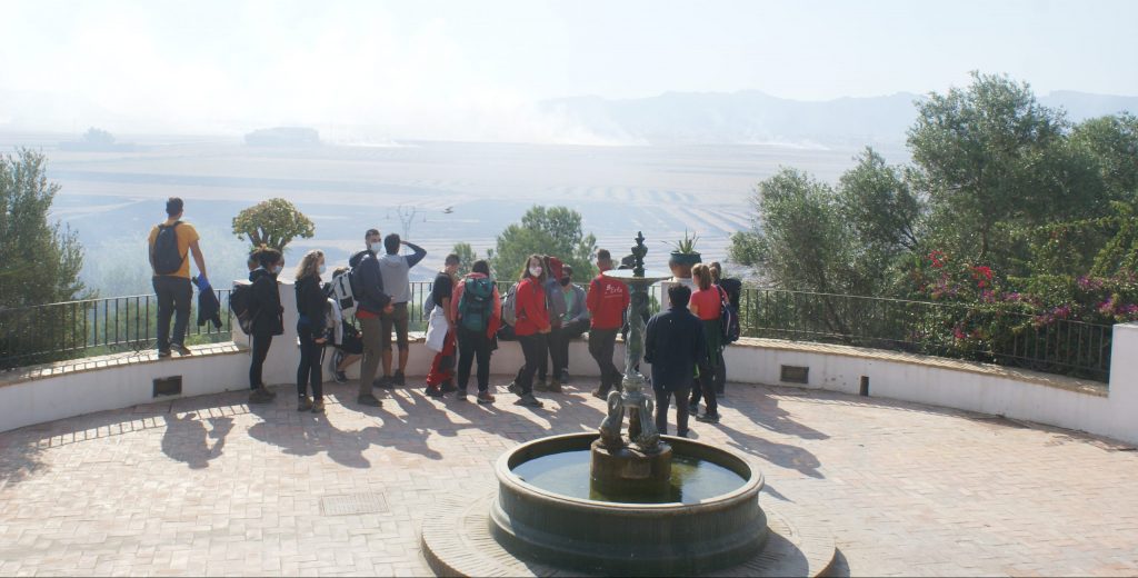
Students of Alicante University did practices in La Albufera
Students of the third course of Geology of the Alicante University within the subject of Regional Geology: visit La Albufera de Valencia. First we have a view of the Ermita dels Sants de la Pedra (Sueca) and then the Silla Port. The evolution of the Albufera from the Middle Ages when was connected with the sea to the today lake was explained. The Moorish expulsion using the today disappeared Sueca Port was pointed as the one of the subject to work with.
The development of the sinus illicitanus (I)
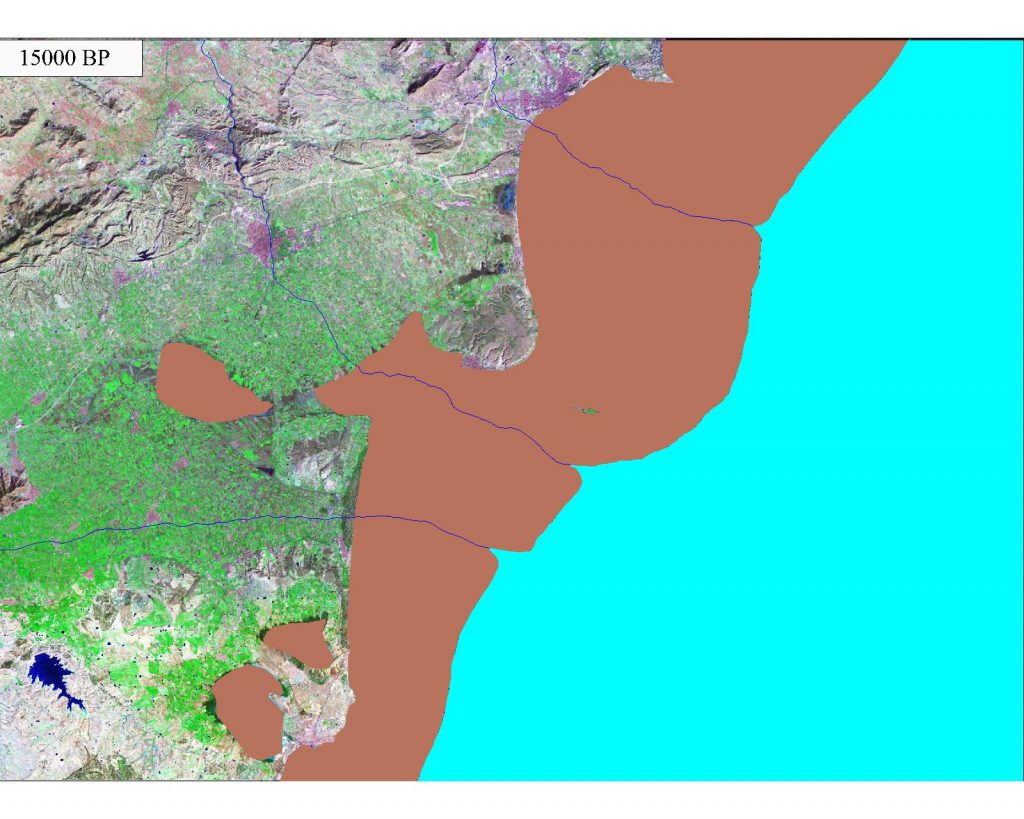
The change of the coastline in the southern part of the province of Alicante for the last 15,000 years have been modeled and described in the work of Tent-Manclus (2013). It is obtained by integrating data from different sources and especially high-resolution seismic profiles of the nearby marine continental shelf. Ten periods have been distinguished in the evolution of the Bajo Segura coastline : 1) 15000 BP- 14600 BP: rapid rise; 2) 14600 BP to 13500 BP: the Older Dryas, slow rise; 3) 13500 BP to 12700 BP: stability and descent; 4) 12700 BP to 11700 BP: the Younger Dryas, descent of the sea level; 5) 11700 BP to 11300 BP: very fast rise; 6) 11300 BP a 8500 BP: rapid rise; 7) 8500 BP = 6500 AC to 8200 BP = 6200 AC: 8.2 ka event stabilization; 8) 6,200 BC to 4,000 BC: rise, Tabarca Island is form; 9) 4000 BC to 3000 BC: the slow rise due to subsidence sinus ilicitanus forms and 10) 3000 BC to the present day 2000 AD: the sinus ilicitanus desiccates.
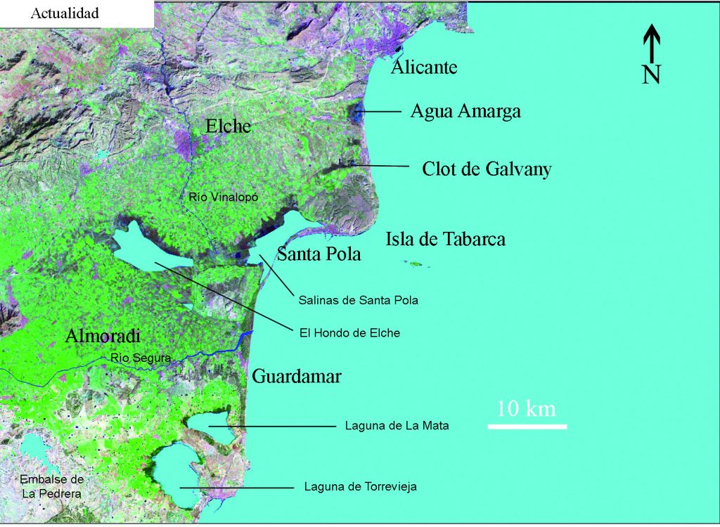
Maps at different times are show selected from the 164 maps that have been made. This is a first version of how the coastline evolves in the region. This work It can be a starting point to improve knowledge of the historical landscape evolution..
The sinus ilicitanus dries until today, the rest of which are the lagoons of the Fondo and Santa Polo Salinas.
Cite as: Tent-Manclús, J. E. (2013): Cambios de la línea de costa en el Bajo Segura (S de Alicante) en los últimos 15.000 años. Estudios geográficos, 74 (275): 684-702. Doi: 10.3989/estgeogr.201324
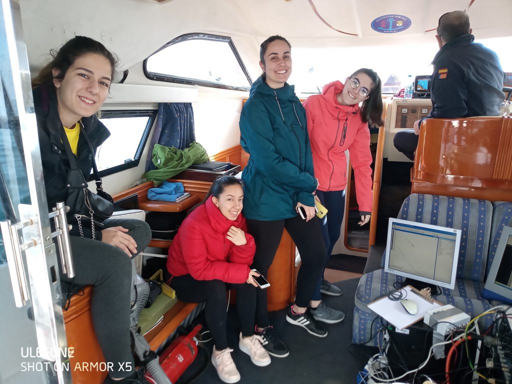
Students of Alicante University do marine geology practices in Denia
Last February 6, 2020, students in the third year of the Marine Geology Degree carried out practices aboard the “Guadalupe” boat. This 12m-length boat assigned to the City of Dénia by the Court of Instruction number 3 of Dénia by the Judge Javier Reyes, is dedicated not only to surveillance tasks of the Marine Reserve of the Cape of San Antonio, but also to operations of pollution control and scientific monitoring of the protected area.
The practice was focused on different aspects of “Geophysics and geophysical prospecting”, under the supervision of Professor José Enrique Tent Manclús. Within a research program of the Multidisciplinary Institute for the Study of the Environment “Ramón Margalef” (IMEM) of the University of Alicante that together with the City Council of Dénia and the National Parks Autonomous Organization operate the Montgó-Dénia Scientific Station (ESCIMO-Dénia).
Taking advantage the good conditions at sea, marine geophysics equipment was tested, specifically a high-resolution marine boomer equipment linked to a differential GPS. The practice was to leave the port, perform the boot sequence and navigate acquiring data. Through sound waves, this equipment allows interpreting the geometry of the layers below the seabed using the same principle as the medical ultrasound, which was precisely developed from this marine technology. Like 2d ultrasound, experience and practice are required for interpretation.
In this first marine campaign, it has been tested the equipment adjustment settings to obtain a better results. The students have been able to see in situ how the equipment studied in the classroom works and, above all, have a first contact with work in the marine environment, much more hostile than the terrestrial to carry out any study.
The marine area of the San Antonio Cape is the extension of the rocky massif of Montgó. The equipment is intended to see the thicknesses of the sandbars and / or sediments trapped by the Posidonia oceanica, above the rocky bottoms. In a future campaign will be locate and delimit the bodies of sand and how they change to areas without sand. In the deepest parts it is expected to be able to locate some level of marine terrace formed when the sea level was lower as a result of the last glaciation. At the last glacial maximum, 18,000 years ago, the sea level was 120 m below the current level. A warming began that caused a rise of 1 to 2 cm a year, but about 14,000 and 11,700 years ago the global climate cooled, which stopped the ascent. This generated rocky coasts that are currently marine terraces between 70 and 60 m deep. After this cold interval known as the “Younger Dryas”, the level rose to reach its current position about 6000 years ago. Younger Dryas terraces have already been located in the coastal area Tabarca Island (South coast Alicante) and in the near future it is intended to study these terraces in the area of San Antonio Cabe.
This study of marine geology together with others of a biological and physical-chemical nature, promoted by the Montgó Scientific Station (ESCIMO-Dénia), not only seeks to improve the knowledge of a very interesting area at the geological level but also to lay the foundations for a proposal to expand and improve the fishing resources for the artisanal fleet around the Marine Reserve as well as the promotion of sustainable activities such as diving.
Recent Comments