Home » Thinkinazul
Category Archives: Thinkinazul
MOLICO-CV a thinkinazul Project
The project will study changes in the coast-line, coastal risk and coastal aquifers, an its logo is:

The leadership of the project is carried out by researches of the MIES is a Multidisciplinary Research Institute for Environmental Studies “Ramón Margalef” (Instituto Multidisciplinario para el estudio del Medio “Ramon Margalef”, IMEM in Spanish) of the Alicante University and integrate researches of 10 universities and research institutions.

The EU funded ThinkInAzul programme supported by MCIN (Ministerio de Ciencia e Innovación) with funding from European Union NextGenerationEU (PRTR-C17.I1) and by Generalitat Valenciana


Marine campaign to find the source of the earthquakes in the Patibulo fishing area (Alicante coast)
At 30 nautical miles to the E of Cabo de Santa Pola (about 55 km) there is a submarine seamount called by the southern Alicante fishermen as the area of the Patibulo (the Gallows). It is an area with a rocky and elevated seabed, with abundant fishing.
Curiously, not only are fish abundant, but from time to time the seismographs of the Alicante University Seismic Record Unit record earthquakes there and along the imaginary line that joins it with Cabo de Santa Pola, to the north of Tabarca Island. In the coastal area to the north of said island, an active fault has already been located through high-resolution seismic as a possible cause of these. It was missing to know if in the Patibulo, said fault continues or another one also active.
Throughout the year 2022, attempts have been made to reach the area from Torrevieja with marine seismic equipment to study the area. It started in the month of April and something always happened, a fuse, a cable, a blown chip, bad weather… After much insistence and returning empty-handed, on December 6, 7 and 8, there was a good weather window and the appliances worked. From the port of Torrevieja with the boat “Rosa de Abril”, we were making some data collection lines in the direction of the Patibulo and on the last day we reached our objective. Almost 80 km of data lines were obtained over 3 days.
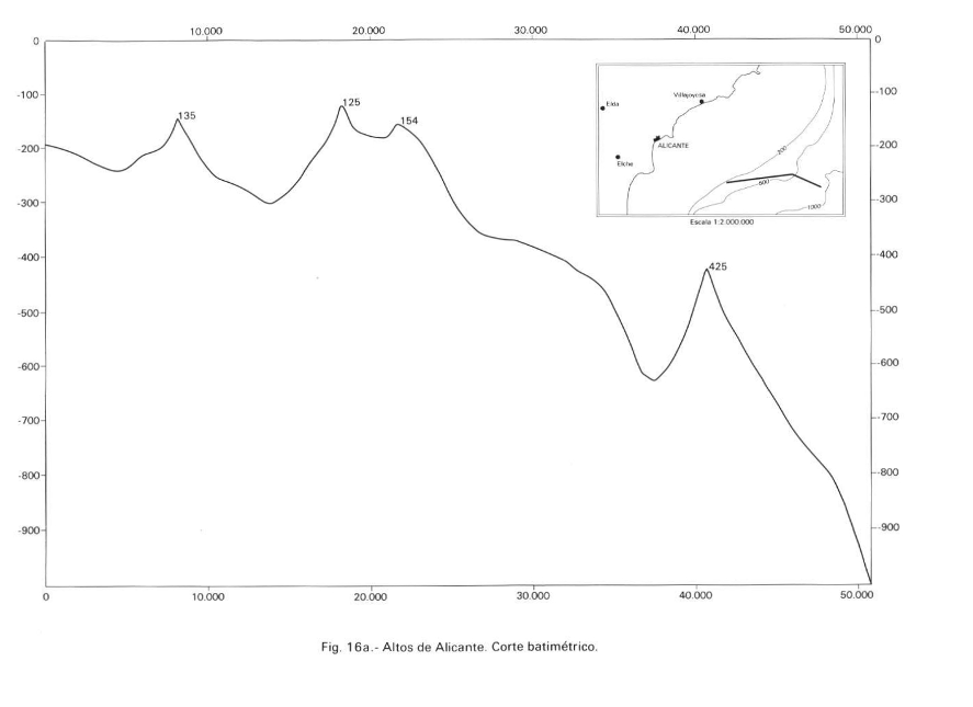
El Patíbulo is the westernmost seamount of an alignment of elevations called Alicante Highs, after the geological map of the Alicante platform (Catafau Alcántara et al., 1994). There are at least three needles whose base is 300 m deep and which rise to about 135 m, the most to the W (Patíbulo). The second is the highest and reaches 125 m (some fishermen say 90 m), the third at 154 m. The image of the geological map of the Alicante platform is attached. To the north of these thresholds begins a submarine canyon that is “unofficially” known as the “Alicante canyon” and that descends to the plain to the north of these.
The high-resolution seismic image shows a fault scarp on the seafloor, indicating that the fault is currently active. The darker area marked by the plane is a more cemented area, probably due to the flow of fluids along the plane. Layered reflectors are also observed, indicating that they are sedimentary rocks and not volcanic rocks like other seamounts in the southern Balearic Islands.
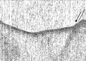
With the preliminary data that has been obtained, it can be said that the Patibulo is a structural height raised by faults. They are active because they protrude from the bottom and because it seems that they are associated with leaks of fluids that mineralize near the fault plane.
We look forward to studying the interesting data obtained.
Reference: Catafau Alcántara, E., Gaytán de Ayala y Bolín, M., Pereda Alonso, I., Vázquez Garrido, J.T., Wandossell Santamaría, J. (1994): Mapa geológico de la Plataforma Continental Española y Zonas adyacentes. Escala 1:200 000. Hoja nº 72-73(Elche-Alicante). ITGE, 73 p.
Thinkinazul meeting in Calpe
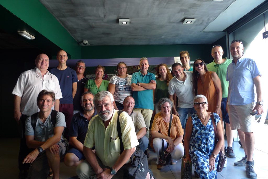
Last september 16th 2022 in the IMEDMAR facilities of the Universitat Católica de Valencia took place the first meeting of the WP1 of the Thinkinazul project.
The meeting did not start quite well because 3 days before the meeting a fire destroyed the entrance of the building so it had to be moved to the Calpe Nautic Club, Belliure brothers meeting room. It was our first meeting, our kicking point trying to find synergies with the different subgroups.
Thinkinazul project
Messinian Group will study the recent marine sediment on the Alicante coast. The new EU funded Thinkinazul project of the Generalitat Valenciana, coded as: GVA/Thinkinazul/2021/039.
The project will study changes in the coast-line, coastal risk and coastal aquifers. It has started on January 1, 2022 and will be active until November 18, 2024. The advances of the research will be announced in future posts of this blog. The leadership of the project is carried out by researches of the MIES is a Multidisciplinary Research Institute for Environmental Studies “Ramón Margalef” (Instituto Multidisciplinario para el estudio del Medio “Ramon Margalef”, IMEM in Spanish) of the Alicante University and integrate researches of 10 universities and research institutions.
Generalitat Valenciana Thinkinazul Project “aquaCHANGE” have been divided in 7 Working Party (WP) and framed in WP1: “Observation and monitoring of the marine and coastal environment”.


Recent Comments