Using drones to map underwater rocky coast (Alicante, Spain)

 Huerta Cape is an urban rocky coast with coves on the city of Alicante coast (SE Spain), between the San Juan beach to the North and the Albufereta beach to the West. This microtidal coast has a 30-cm tidal amplitude. The basement is made of latest Tortonian 20º- north dipping sandstones covered by flat-laying Tyrrhenian beach microconglomerate with Tethystrombus latus and other Senegalese fauna (MIS 5e, about 120 ka). About 25 UAV (Unmanned Aerial Vehicle)/drone flights have been made on the south Alicante beaches at different flight heights and times of the day, always with appropriate weather conditions, near no-waves flat sea surface, to obtain the best adjustment of sunlight reflection to avoid sunglint and capture the best view of the sea bottom. The flights were designed with the application Dronelink for fast and reproducible flights. The best result was in the wintertime, middle of the morning, and 40 -m-high flights, producing a set of 11 good quality drone flights, a total of 3435 azimuthal photographs were taken. Each flight was processed separately using different photogrammetric software with variable settings to find the best procedure. The best individual 3D models were obtained with the WebODM software. Then flights were grouped in two sets, one with 4 flights corresponding to 1239 valid pictures, and the other 7 flights with 2002 valid pictures. The two 3D models show 2 underwater erosion platforms plus today’s forming vermetid -rimmed platform. It can also be mapped in many blocks, some underwater and others in the foreshore. The fractures could be followed underwater to a depth of about 5 m and the Tyrrhenian level beach microconglomerate could be mapped underwater. Finally, the underwater rocky bottom outcrops are found aligned, producing sandy bottom bands in the slightly eroded levels, whereas bands of Posidonia oceanica could be clearly distinguished in the rocky elevations. This methodology makes it fast and easy to monitor the coastal dynamics until the 3 to 5 m depth where the side scan sonar surveys fail or decrease the quality of the data.
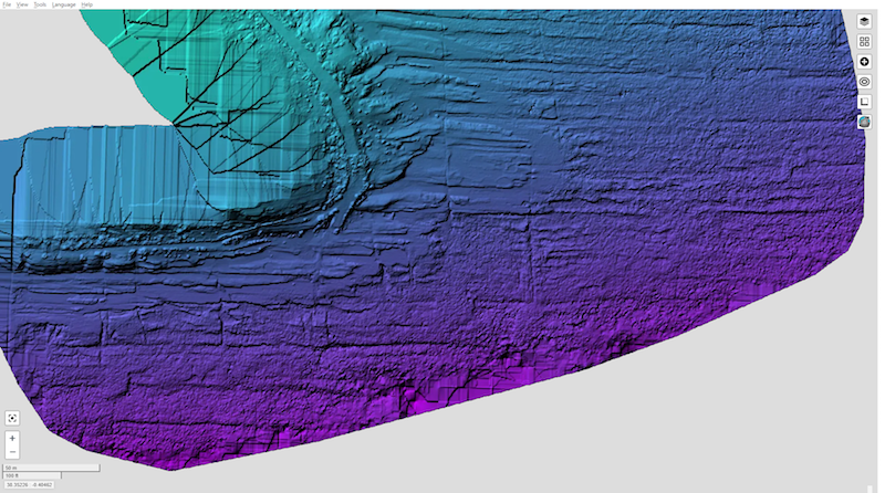
Cite as: Tent-Manclús, J. E. y Bonomo, D. (2025). Using an UAV/drone to map underwater rocky coast (Huerta Cape, Alicante, SE Spain). In: Morales, J. A., Carro, B. M., Cantero, C. y Amador-Luna, D. (Eds.). Sedimentology on the estuary shore 38th IAS Meeting Huelva-Spain, 26-28 June 2025. 304.
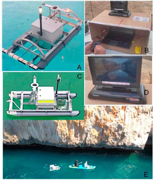
Low-cost unmanned surface vehicle: development and applications


A) Self-developed USV (Unmanned Surface Vehicle) in development phase I, with position, starboard and port side lights and GPS tracker. B) Custom control working station. C) USV development phase II, the platform has been improved with a submerged and a frontal camera (to the right) plus two antennas, one for amplify the RC communication signal and the other for real time video broadcast. D) Real time video display of one-at-time cameras installed on USV. E) USV man-powered example in a Side Scan Scan survey of a sea-cliff.

cite as: Benabdeloued, B. Y. N., Ronda, J. L., Bonomo, D., Tent-Manclús, J. E., 2025. Low-cost unmanned surface vehiche: Development and Applicantions. In: Furlani, S., Devoto, S., Pappalardo, M., Gomez-Pujol, L. y Strelecki, M. (Eds.). International Rock Coast Conference 2025. A state of the art, Trieste Italia, 25-26 June 2025. 26-27 p.

1st Symposium Redes Fantasma

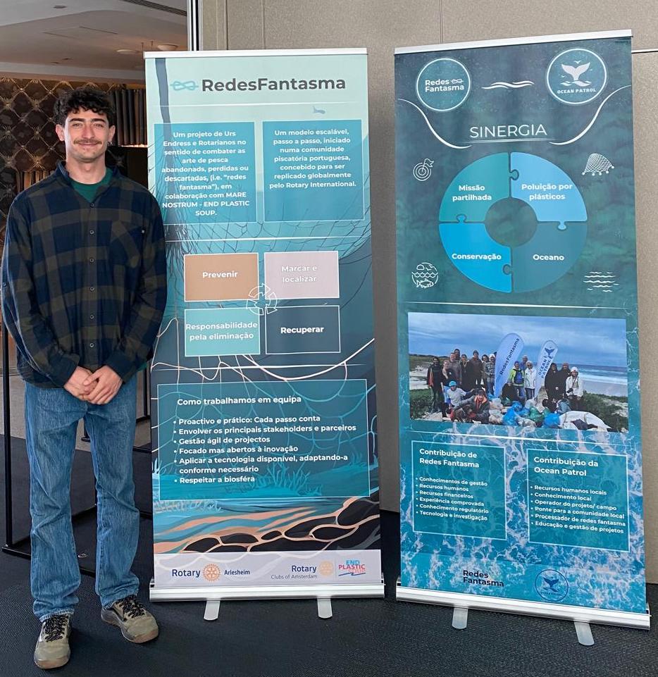
The Redes Fantasma is a symposium about lost marine trawls, to mark and to try to recover them held in Peniche (Portugal) on March 20th 2025. It was organized by the Rotary Club Atlantico Região Oeste D1960 with collaboration in the organization of NGO Ocean Patrol.

Our Ph D student Davide Bonomo was participating with an speak about Side Scan Sonar.

Side Scan Sonar Study of the Morro de Toix Seacliff base (Calpe, Alicante)

The Morro de Toix seacliff, located South of Calpe, on the Alicante coast in southeastern Spain, is a 70 to 30 m high seacliff. The western portion is plane and eastern portion of the seacliff is highly karstified and overhanging. The foot is currently submerged. An USV (Unmanned Surface Vessel) platform adapted to be towed by a manned vehicle, a paddle surfboard, has been used, with the aim of studying the geomorphology of the underwater part. To study the submerged bottom of the cliff, an USV (Unmmaned Surface Vessel) platform has been used. It has been adapted to be towed by a crewed vehicle, a paddle surfboard. This is an easy and fast procedure when a short excellent weather conditions windows is found obtaining good side scan sonar, single beam and downscan data. The result of the processed data has shown a metric-blocky seabed near the cliff and the underwater cliff is excavated around 3-4 m in the western portion and irregulary excavated in the eastern part with many cove and caves.

Morro de Toix Seacliff

cite as: Bonomo, D., Ronda, J. L., Benabdeloued, B. Y. N., Tent-Manclús, J. E., Salcedo-Justicia, E. M. y Alcántara-Carrió, J. (2024): Estudio con sonar de barrido lateral de la base del acantilado del Morro de Toix (Calpe, Alicante). In: Palomar Vazquez, J. y Pardo Pascual, J. (Eds.). GEOLIT24 – Libro de Actas – XII Jornadas de Geomorfología Litoral. 25-27 de septiembre de 2024. Valencia. 254-259. https://doi.org/10.4995/GEOLIT24.2024.18726

IX International Symposium on Marine Sciences (Valencia).

Our thinkinazul project Molico-CV presented four works at the XII Jornadas de Geomorfologia Litoral held in Valencia (Spain) from September 25 to 27, 2024.

  1. Morphometric analysis of the Alicante coast.
  2. The Ifach Rock and the coast between Calpe and Moraira.
  3. Side Scan Sonar in Morro de Toix (Calpe).
  4. The notch in Morro de Toix (Calpe).

Works presented to the IX International Symposium on Marine Sciences (Valencia):

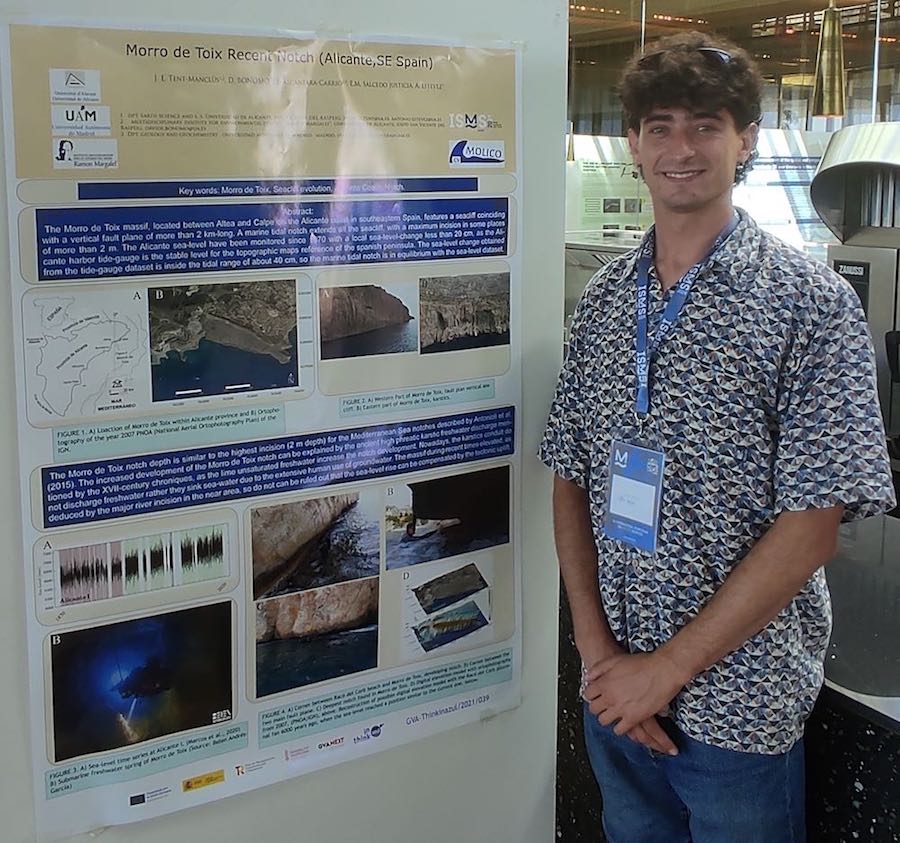
Davide Bonomo in front or the 1092 poster; Tent-Manclús, J. E., Bonomo, D., Alcántara-Carrió, J., Salcedo-Justicia, E. M. y Estévez, A. (2024): Morro de Toix recent notch (Alicante, SE Spain). IX International Symposium on Marine Sciences (Valencia).
  1. Benabdeloued, B. Y. N., Ronda, J. L., Tent-Manclús, J. E., Bonomo, D. y Alcántara-Carrió, J. (2024): Coastal studies with an USV. IX International Symposium on Marine Sciences (Valencia). 1083 Poster
  2. Alcántara-Carrió, J., Fontán-Bouzas, A., Bonomo, D. y Tent-Manclús, J.E. (2024): Geomorphological análisis of the inner continental shelf of the Prebetic system (southeast Iberian Peninsula). IX International Symposium on Marine Sciences (Valencia). 1089 Poster
  3. Tent-Manclús, J. E., Bonomo, D., Alcántara-Carrió, J., Salcedo-Justicia, E. M. y Estévez, A. (2024): Morro de Toix recent notch (Alicante, SE Spain). IX International Symposium on Marine Sciences (Valencia). 1092 Poster
  4. Bonomo, D., Tent-Manclús, J. E., Alcántara-Carrió, Portantiolo Manzolli, R., Jordá Guijarro, J., Arteaga Cardineau, J., Navarro Pedreño, J., Jordan, M. y Narváez, C. R. (2024): Record of a high energy event in the coastal plain of Guardamar de Segura (Alicante, SE Spain). IX International Symposium on Marine Sciences (Valencia). 1094 Poster

XII Geolit Congress (Valencia)

Our thinkinazul project Molico-CV presented four works at the XII Jornadas de Geomorfologia Litoral held in Valencia (Spain) from September 25 to 27, 2024.

  1. Morphometric analysis of the Alicante coast.
  2. The Ifach Rock and the coast between Calpe and Moraira.
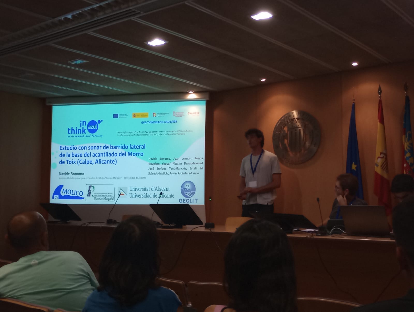
  3. Side Scan Sonar in Morro de Toix (Calpe).
  4. The notch in Morro de Toix (Calpe).
Davide Bonomo presenting the Side Scan Sonar work in Morro de Toix.

Works presented to the XII Jornadas de Geomorfología Litoral:

  1. Alcántara Carrió, J., Tent Manclús, J. E., Bonomo, D., Fontán Bouzas, A., Portz, L. y Manzolli, R. (2024): High-resolution morphometric analysis of the rocky coast of the Prebetic System (southeast Iberian Peninsula). In: Palomar Vazquez, J. y Pardo Pascual, J. (Eds.). GEOLIT24 – Libro de Actas – XII Jornadas de Geomorfología Litoral. 25-27 de septiembre de 2024. Valencia. 214-220. https://doi.org/10.4995/GEOLIT24.2024.18736
  2. Alcántara Carrió, J., Tent Manclús, J. E., Bonomo, D., Fontán Bouzas, A., Portz, L. y Manzolli, R. (2024): The Pleistocene double tombolo of Calpe and the submerged fault scarps between Moraria Point and Ifach Rock (southeast Iberian Peninsula). In: Palomar Vazquez, J. y Pardo Pascual, J. (Eds.). GEOLIT24 – Libro de Actas – XII Jornadas de Geomorfología Litoral. 25-27 de septiembre de 2024. Valencia. 221-227. https://doi.org/10.4995/GEOLIT24.2024.18864.
  3. Bonomo, D., Ronda, J. L., Benabdeloued, B. Y. N., Tent-Manclús, J. E., Salcedo-Justicia, E. M. y Alcántara-Carrió, J. (2024): Estudio con sonar de barrido lateral de la base del acantilado del Morro de Toix (Calpe, Alicante). In: Palomar Vazquez, J. y Pardo Pascual, J. (Eds.). GEOLIT24 – Libro de Actas – XII Jornadas de Geomorfología Litoral. 25-27 de septiembre de 2024. Valencia. 254-259. https://doi.org/10.4995/GEOLIT24.2024.18726.
  4. Tent-Manclús, J. E., Bonomo, D., Alcántara-Carrió, J. y Salcedo-Justicia, E. M. (2024): Evolución reciente del notch del acantilado marino del Morro de Toix (Alicante, SE España). In: Palomar Vazquez, J. y Pardo Pascual, J. (Eds.). GEOLIT24 – Libro de Actas – XII Jornadas de Geomorfología Litoral. 25-27 de septiembre de 2024. 318-323. Valencia.  https://doi.org/10.4995/GEOLIT24.2024.18729

Spanish Geological Congress in Avila

Our thinkinazul project Molico-CV presented three presentations at the XI Spanish Geological Congress held in Ávila (Spain) from July 1 to 6, 2024.

  1. A high energy event in the last 2000 years at Guardamar de Segura.
  2. The Seacliff of Morro de Toix (Alicante)
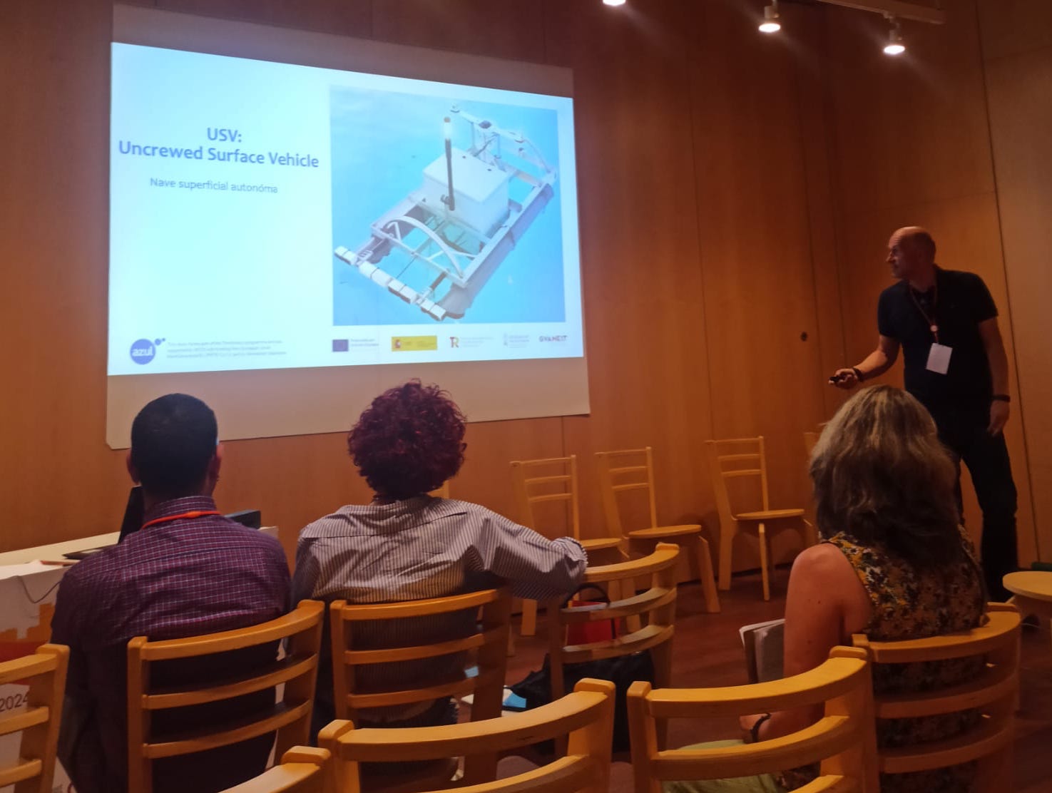
  3. The development of a homemade USV (Uncrewed Surface Vehicle). See the picture bellow.

Works presented to the XI Spanish Geological Congress:

  1. Benabdeloued, B. Y. N., Ronda, J. L., Tent-Manclús, J. E., Bonomo, D. y Alcántara-Carrió, J. (2024): Desarrollo de un USV para trabajos costeros. Geotemas, 20: 46.
  2. Bonomo, D., Tent-Manclús, J. E., Alcántara-Carrió, J., Portantiolo Manzolli, R., Jordá Guijarro, J., Arteaga Cardineau, C., Navarro Pedreño, J., Jordan, M., y Narváez, C. R. (2024): Registro de un evento de alta energía en la planicie costera de Guardamar de Segura (Alicante, SE España). Geotemas, 20: 1132-1135.
  3. Tent-Manclús, J. E., Bonomo, D., Alcántara-Carrió, J. y Estévez, A. (2024): Evolución reciente del acantilado marino del Morro de Toix (Alicante, SE España). Geotemas, 20: 89-92.

Alicante 2024 Thinkinazul meeting

Last june 11th to 13th 2024 in the Universidad de Alicante facilities took place the third meeting of the of the Valencian Comunity Thinkinazul project.

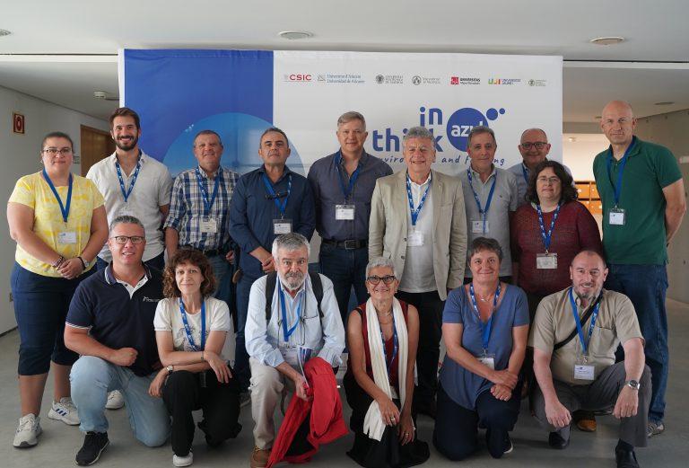
The meeting was in the Alfredo Orts degrees room. Below a picture of some of the attendents.

Working Package 1 group in the Alicante meeting of the Thinkingazul project

ROV driving experience

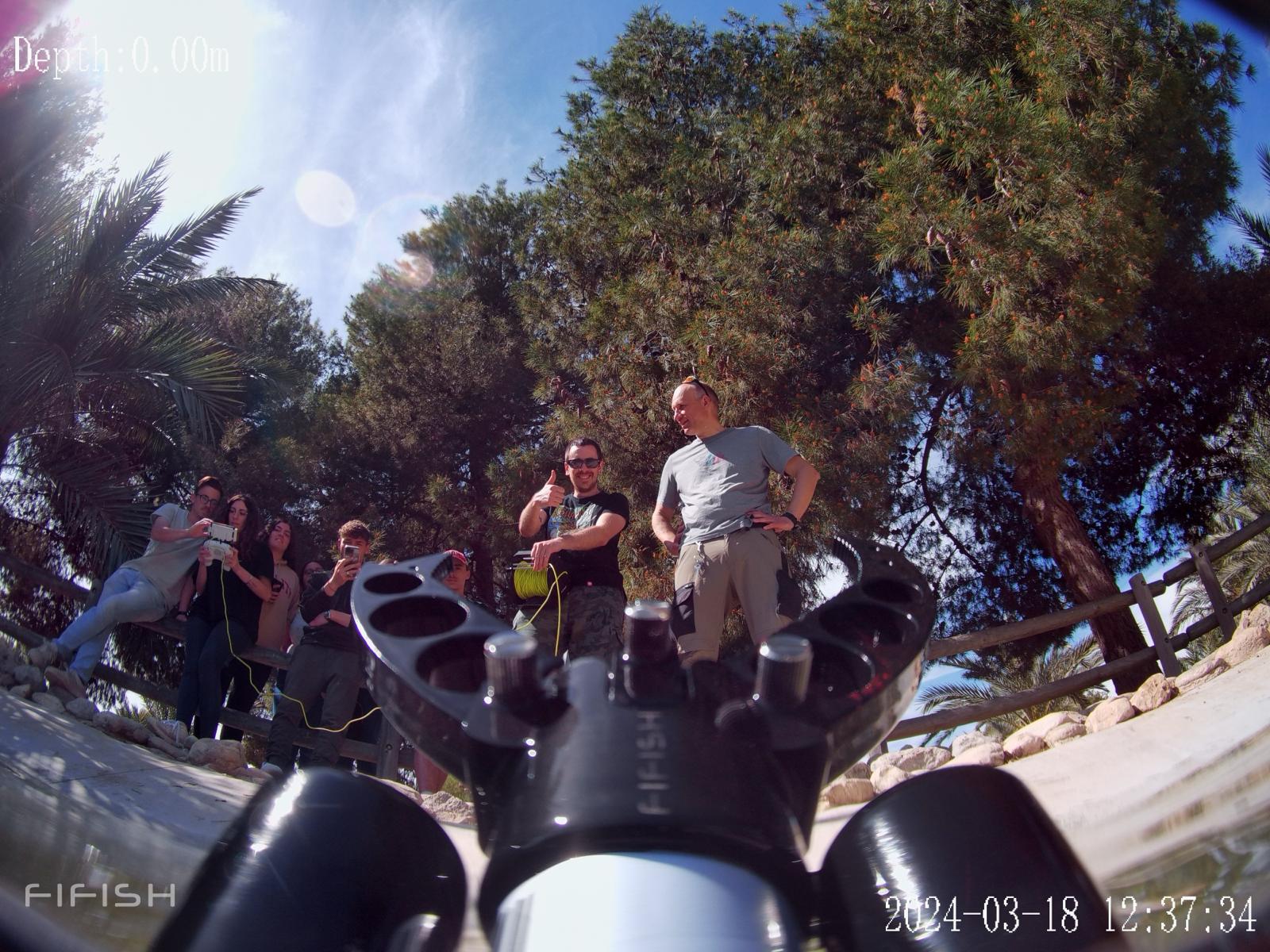
Students in the third year of the  Geology Degree of the course “Geophysics and geophysical prospecting”, under the supervision of Professor José Enrique Tent Manclús, carried out practices in the University of Alicante Ducks pond to learn how to drive a ROV. The picture show some students trying to understand the ROV commands (left).

Students seen by a picture taken from the ROV

Best article in the field of marine technology and renewable energy in the Martech workshop

Award for the best article in the field of marine technology and renewable energy sponsored by Nautilus Oceanica at the Martech 2023 congress, Tenth international workshop on marine technology, Jaume I University, Castellón de la Plana. For the article entitled: “Low cost USV development to study spring ponds” by Ronda, J. L., Benabdeloued, B. Y. N. and Tent-Manclús, J. E. belonging to the Department of Earth and Environmental Sciences and the Seismic Network of the Valencian Community (SISCOVA).

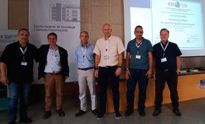
Award concession, from left to right: Alejandro Palmeriro Nautilus Oceanica representative, Raúl Marín Prades chairman of the organizing committee, Pedro José Sanz Valero del Irtesu, José Enrique Tent Manclús, Nassim Benabdeloued, Juan Leandro Ronda.

The article deals with the development of a USV (Unmanned Surface Vehicle) a surface unmanned ship for the study of springs. It is a small remote-controlled vehicle with a control post, from where it is manned. It has two cameras, one underwater and one frontal, which transmit real-time GPS location, also in real time, and bathymetry probe sensors and side-scan Sonar.


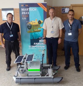
The USV and the authors of the work. From left to right: Juan Leandro Ronda, José Enrique Tent-Manclús y Nassim Benabdeloued

The authors with the USV team.