Home » 2023
Yearly Archives: 2023
Sorbas field trip Alicante Marine Sciences 2023
This year the students of the third course of Marine sciences of the Alicante University visit the Mesa de Rodan, Cabo de Gata, and Sorbas basin on November 2nd and 3th of 2023.
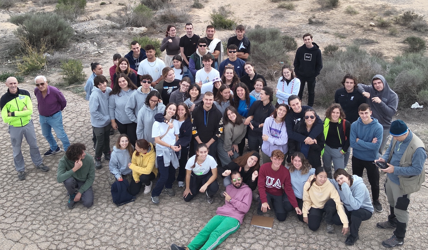
The picture show the student visiting the Sorbas gypsum karst (Almeria).
The professors of the subject were Antonio Estévez, Manuel Martín-Martín, David Bonomo, and José Enrique Tent-Manclús.
Best article in the field of marine technology and renewable energy in the Martech workshop
![]()
![]()
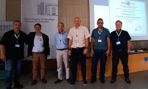
Award for the best article in the field of marine technology and renewable energy sponsored by Nautilus Oceanica at the Martech 2023 congress, Tenth international workshop on marine technology, Jaume I University, Castellón de la Plana. For the article entitled: “Low cost USV development to study spring ponds” by Ronda, J. L., Benabdeloued, B. Y. N. and Tent-Manclús, J. E. belonging to the Department of Earth and Environmental Sciences and the Seismic Network of the Valencian Community (SISCOVA).
The article deals with the development of a USV (Unmanned Surface Vehicle) a surface unmanned ship for the study of springs. It is a small remote-controlled vehicle with a control post, from where it is manned. It has two cameras, one underwater and one frontal, which transmit real-time GPS location, also in real time, and bathymetry probe sensors and side-scan Sonar.
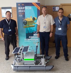
The authors with the USV team.
![]()
![]()
MOLICO-CV a thinkinazul Project
The project will study changes in the coast-line, coastal risk and coastal aquifers, an its logo is:
![]()
The leadership of the project is carried out by researches of the MIES is a Multidisciplinary Research Institute for Environmental Studies “Ramón Margalef” (Instituto Multidisciplinario para el estudio del Medio “Ramon Margalef”, IMEM in Spanish) of the Alicante University and integrate researches of 10 universities and research institutions.
![]()
The EU funded ThinkInAzul programme supported by MCIN (Ministerio de Ciencia e Innovación) with funding from European Union NextGenerationEU (PRTR-C17.I1) and by Generalitat Valenciana
![]()
![]()
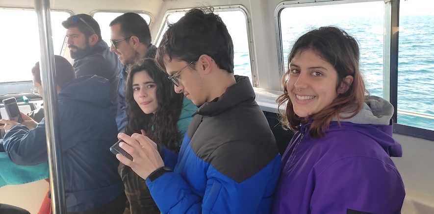
Students of Alicante University do marine geology practice in Torrevieja
Last March 4th, 2023, students in the third year of the Geology Degree carried out practices aboard the “Rosa de Abril” boat from the Torrevieja harbor . The practice was focused on different aspects of “Geophysics and geophysical prospecting”, under the supervision of Professor José Enrique Tent Manclús. This academic we have returned to sail as before the pandemic.
Marine campaign to find the source of the earthquakes in the Patibulo fishing area (Alicante coast)
At 30 nautical miles to the E of Cabo de Santa Pola (about 55 km) there is a submarine seamount called by the southern Alicante fishermen as the area of the Patibulo (the Gallows). It is an area with a rocky and elevated seabed, with abundant fishing.
Curiously, not only are fish abundant, but from time to time the seismographs of the Alicante University Seismic Record Unit record earthquakes there and along the imaginary line that joins it with Cabo de Santa Pola, to the north of Tabarca Island. In the coastal area to the north of said island, an active fault has already been located through high-resolution seismic as a possible cause of these. It was missing to know if in the Patibulo, said fault continues or another one also active.
Throughout the year 2022, attempts have been made to reach the area from Torrevieja with marine seismic equipment to study the area. It started in the month of April and something always happened, a fuse, a cable, a blown chip, bad weather… After much insistence and returning empty-handed, on December 6, 7 and 8, there was a good weather window and the appliances worked. From the port of Torrevieja with the boat “Rosa de Abril”, we were making some data collection lines in the direction of the Patibulo and on the last day we reached our objective. Almost 80 km of data lines were obtained over 3 days.
El Patíbulo is the westernmost seamount of an alignment of elevations called Alicante Highs, after the geological map of the Alicante platform (Catafau Alcántara et al., 1994). There are at least three needles whose base is 300 m deep and which rise to about 135 m, the most to the W (Patíbulo). The second is the highest and reaches 125 m (some fishermen say 90 m), the third at 154 m. The image of the geological map of the Alicante platform is attached. To the north of these thresholds begins a submarine canyon that is “unofficially” known as the “Alicante canyon” and that descends to the plain to the north of these.
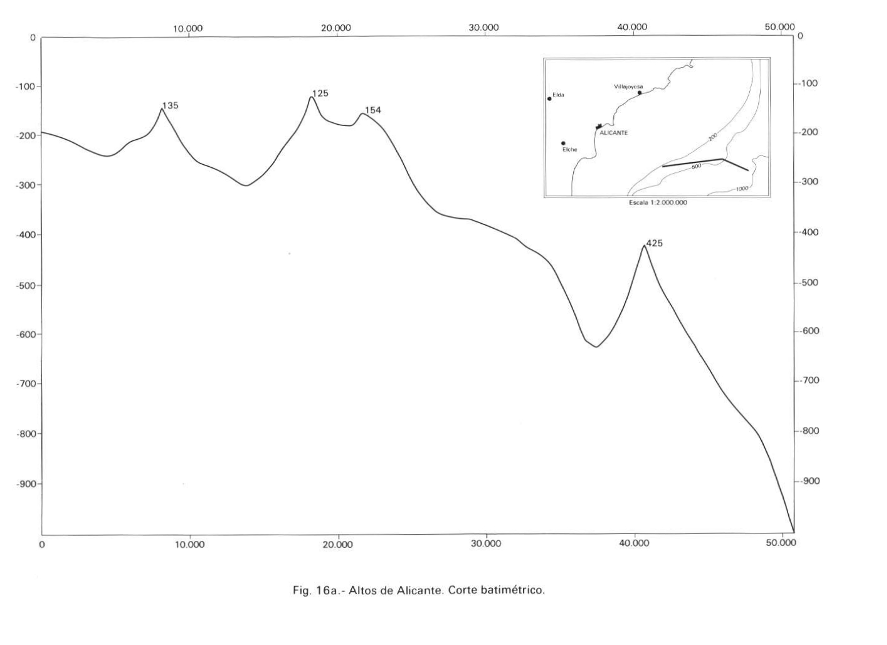
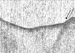
The high-resolution seismic image shows a fault scarp on the seafloor, indicating that the fault is currently active. The darker area marked by the plane is a more cemented area, probably due to the flow of fluids along the plane. Layered reflectors are also observed, indicating that they are sedimentary rocks and not volcanic rocks like other seamounts in the southern Balearic Islands.
With the preliminary data that has been obtained, it can be said that the Patibulo is a structural height raised by faults. They are active because they protrude from the bottom and because it seems that they are associated with leaks of fluids that mineralize near the fault plane.
We look forward to studying the interesting data obtained.
Reference: Catafau Alcántara, E., Gaytán de Ayala y Bolín, M., Pereda Alonso, I., Vázquez Garrido, J.T., Wandossell Santamaría, J. (1994): Mapa geológico de la Plataforma Continental Española y Zonas adyacentes. Escala 1:200 000. Hoja nº 72-73(Elche-Alicante). ITGE, 73 p.
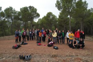
Field trip to Teruel
This academic year 2022-23 we have returned to Teruel Paleozoic as before the pandemic. The geology students of Alicante University third course within the subject of Regional Geology: visit Montealegre del Castillo triassic section (Albacete), Aguilon Jurassic section (Teruel), Murero Cambrian Rambla Valdemiedes section (Zaragoza), Luesma Ordovicic to Triassic section (Teruel), Santa Cruz de Nogueras museum “Paleozoic Seas Museum” (Teruel), Ojos Negros iron-ore quarry (Teruel) and Checa-Orea road Ordovicic-Silurian section (Guadalajara).
The picture shows all the students on the Tertiary erosional surface on top of the Murero section (Zaragoza province).
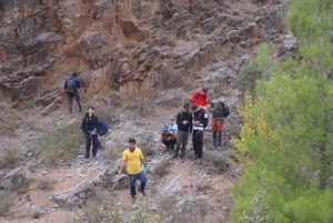
The second picture show students in the Murero Cambrian Rambla de Valdemiedes section.
Recent Comments