Home » Articles posted by messinianalicante (Page 2)
Author Archives: messinianalicante
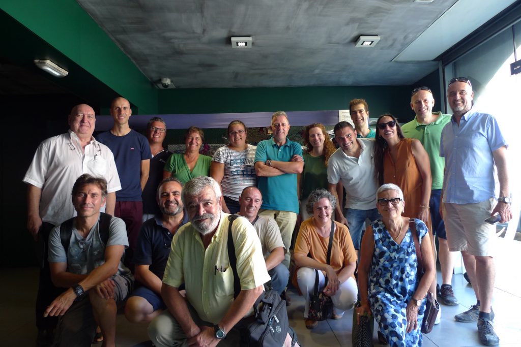
Thinkinazul meeting in Calpe
Last september 16th 2022 in the IMEDMAR facilities of the Universitat Católica de Valencia took place the first meeting of the WP1 of the Thinkinazul project.
The meeting did not start quite well because 3 days before the meeting a fire destroyed the entrance of the building so it had to be moved to the Calpe Nautic Club, Belliure brothers meeting room. It was our first meeting, our kicking point trying to find synergies with the different subgroups.
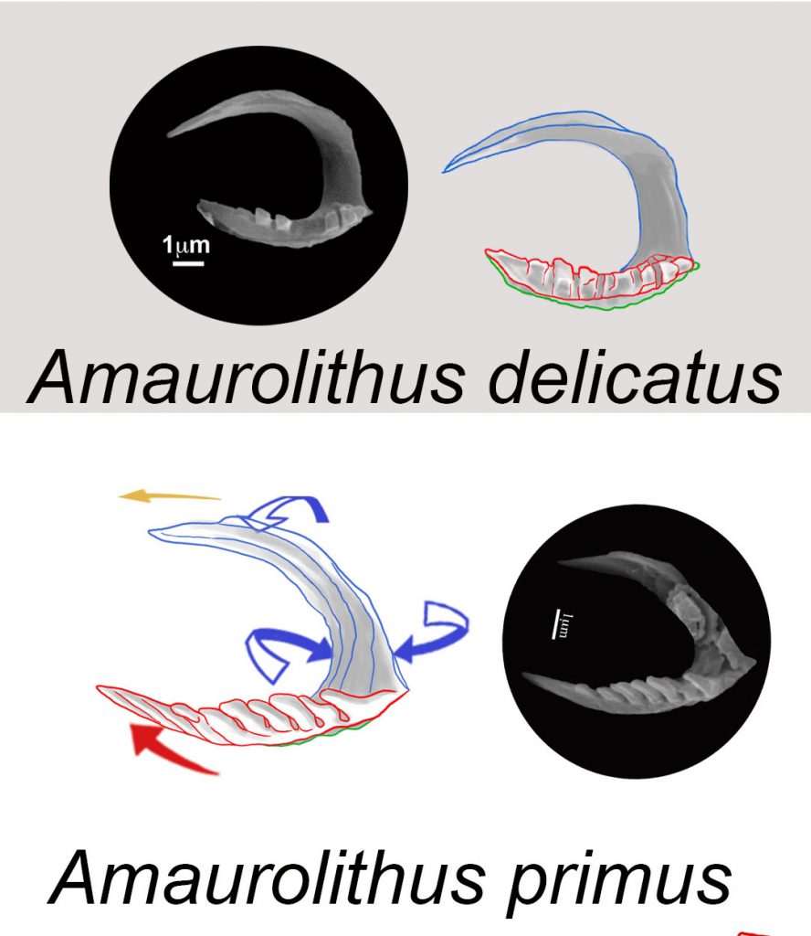
Evolution of Amaurolithus: Amaurolithus delicatus marking the Messinian bottom
After a complete study of the sediment samples from Ocean Drilling Program (ODP) Sites 999 and 1237 in the Caribbean Sea and Eastern Pacific Ocean in order to monitor the evolution of ceratoliths. The First Occurrence of Amaurolithus delicatus marks the bottom of the Messinian Stage. The first ceratholith, A. primus, has two arms and a horseshoe shape with marked laths, and is stable and concave upwards having three blades (sinistral=blue, median=red, and dextral= green).
Early robust A. primus evolved into stylised forms and then to Amaurolithus delicatus (7.226 Ma), an almost plain horseshoe ceratolith with two arms. The left arm, usually the longer one, comes from the sinistral wing of A. primus and has a characteristic flattened omega section (Ω) without laths. There is a distribution overlap between A. primus and A. delicatus; the highest occurrence of the first one, at 6.282 Ma, is a newly proposed bioevent for the Messinian. After this, Amaurolithus does not have laths on its longer left arm and should be included in A. delicatus.
Cite as: Lancis, C., Tent-Manclús, J.-E., Flores, J.-A., 2022. Origin and evolutionary trends of the Neogene genera Amaurolithus and Nicklithus (calcareous nannofossils). Mar. Micropaleontol. 175, 102156. https://doi.org/https://doi.org/10.1016/j.marmicro.2022.102156
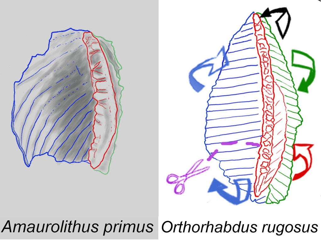
Origin of the ceratolith genus Amaurolithus
Sediment samples from Ocean Drilling Program (ODP) Sites 999 and 1237 in the Caribbean Sea and Eastern Pacific Ocean were studied to monitor the evolution of ceratoliths from 7.4 Ma to 6 Ma. Orthorhabdus rugosus shows high variability at the end of the Tortonian to the Early Messinian (7.35 Ma to 6.91 Ma), resulting in the Amaurolithus (7.354 Ma) and Nicklithus branches (6.985 Ma). Orthorhabdus rugosus is an ortholith with three blades (sinistral, median, and dextral). The first ceratholith, A. primus, has two arms and a horseshoe shape with marked laths, and is stable and concave upwards. Its sinistral arm is formed from the sinistral blade of Orthorhabdus rugosus and the right arm is formed from the other blades.
The sudden appearance of A. primus in the sedimentary record at around 7.35 Ma was observed in both studied sections . The Figure shows the set modifications of O. rugosus producing the early A. primus. The modifications are not a gradual evolutionary sequence of intermediate progressively modified forms but occur simultaneously as they are present from the beginning of the first recorded specimens. Amaurolithus primus coexisted with the O. rugosus ancestor in the studied samples.
Cite as: Lancis, C., Tent-Manclús, J.-E., Flores, J.-A., 2022. Origin and evolutionary trends of the Neogene genera Amaurolithus and Nicklithus (calcareous nannofossils). Mar. Micropaleontol. 175, 102156. https://doi.org/https://doi.org/10.1016/j.marmicro.2022.102156
Thinkinazul project
Messinian Group will study the recent marine sediment on the Alicante coast. The new EU funded Thinkinazul project of the Generalitat Valenciana, coded as: GVA/Thinkinazul/2021/039.
The project will study changes in the coast-line, coastal risk and coastal aquifers. It has started on January 1, 2022 and will be active until November 18, 2024. The advances of the research will be announced in future posts of this blog. The leadership of the project is carried out by researches of the MIES is a Multidisciplinary Research Institute for Environmental Studies “Ramón Margalef” (Instituto Multidisciplinario para el estudio del Medio “Ramon Margalef”, IMEM in Spanish) of the Alicante University and integrate researches of 10 universities and research institutions.
Generalitat Valenciana Thinkinazul Project “aquaCHANGE” have been divided in 7 Working Party (WP) and framed in WP1: “Observation and monitoring of the marine and coastal environment”.

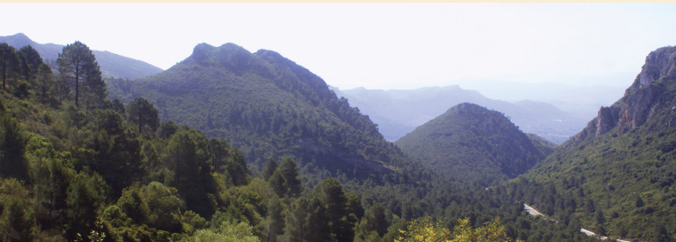
Sot de Chera field trip
Students of the third course of Geology of the Alicante University within the subject of Regional Geology: visit Jarafuel triassic section, Montealegre del Castillo triassic section, Sot de Chera Jurassic section and Monduver geologic dome.
The picture shows the in the Chulilla health resort section near by Sot de Chera (Valencia province)
Field Trip to Almeria
This year the students of the third course of Marine sciences of the Alicante University visit the Sorbas basin, Cabo de Gata, and Mesa de Roldán on November 4th and 5th of 2021.
The picture show the student visiting the Torregarcia beach and the Roman remains of a cetaria (a marine factory).
The professors in charge were Antonio Estévez, Manuel Martín-Martín and José Enrique Tent-Manclús.
Monduver Paleolandslide as its relationship with the human use of the Parpalló Cave (Valencia province, Spain)
The Monduver massif located 50 km to the south-east of Valencia city has a well-developed Karst geomorphology and where it stands out the Barx Polje. The Highest point of the Massif, Moduver 841 m a.s.l., is just 10 km inland from the Mediterranean coast. The Parpallo Cave located at the southern part of the polje is one of the most important Palaeolithic sites, not only in Spain, but in the world due to the collection of decorated plaquettes of Palaeolithic portable art. The collection covers the entire archaeological sequence from the Gravettian to the Magdalenian periods (26000–11000 years BP). The Barx polje has two subbasins: Barx to the north and La Drova to the south, and the second one is partly capture at the south by the Caldereta Creek. In this work is proposed than the La Drova subbasin was formed by a major landslide of the western side of the Monduver massif producing a natural dam of the Les Voltes Creek. Lately, the La Drova subbasin was filled by the terra rossa product of the limestone dissolution of the polje basin, as can be see today in the sides of the captured La Drova subbasin. The filling of the subbasin was to a level higher that the Barx subbasin as the today drainage of the uncaptured La Drova runs to this last one. Three 3d model landscape figures has been made to explain its evolution. The archeological sequence of the Parpallo Cave could be related with the infilling of the subbasin period and the landslide could take place before the human use of the cave.
Cite as: Tent-Manclús, J. E. y Jordá Guijarro, J. (2021): Monduver Paleolandslide as its relationship with the human use of the Parpalló Cave (Valencia province, Spain). LAC1+1, Landscape archaeology conference, 8-11 june 2021 Book of Abstracts. 14 p.
Pottery clays quarries in the domain territory of ancient Ilici (Alicante, SE Spain)
The Alcudia archaeological site correspond to the ancient city of Ilici (Roman Colonia Iulia Ilici Augusta). The site consists of an succession of Iberian, roman, byzantine, Visigoth and Moorish settlements (since the 5th centuries BC to the 8th century AC) on the top of a hill that in the 1st century BC was surrounded by a wall and nearby the Vinalopó river mouth in the Bajo Segura Bay. This bay was known in Roman times as the sinus Ilicitanus. Different clays of the area nearby to the site have been sampled, analysed and then compared with analysis of some pottery remains of the different periods of the Alcudia settlement. The clays have been analysed by micro-X Ray fluorescence (µXRF) and by infrared spectrometry by Fourier transformed (ATR-FTIR), as crude, mixed in different proportions, and then heated to a different temperature until 900ºC. The old remains show affinities with the clays sampled from the Eastern part indicating a W-E influence, as the northern coast of the sinus ilicitanus. During the roman period and later the pottery was made using the nearby clays located just to the north of the site clearly influenced by the via Augusta. The topography to the north of the site is formed by low but steep hills and small creeks that possibly limit the commerce to the north, so the commerce follows the marine plain coast of the northern sinus ilicitanus. The opening of the roman road via August along the Vinalopó Valley favoured the use of pottery clays from the interior of the territory.
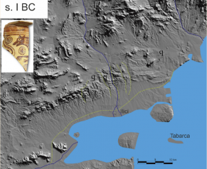
Cite as: Jordá Guijarro, J., Cerdán Sala, M., Sánchez-Sánchez, A., Ronda Femenia A., Tendero Porras, M. and Tent-Manclús, J. E. (2021): Pottery clays quarries in the domain territory of ancient Ilici (Alicante, SE Spain). LAC1+1, Landscape archaeology conference, 8-11 june 2021 Book of Abstracts. 45 p.
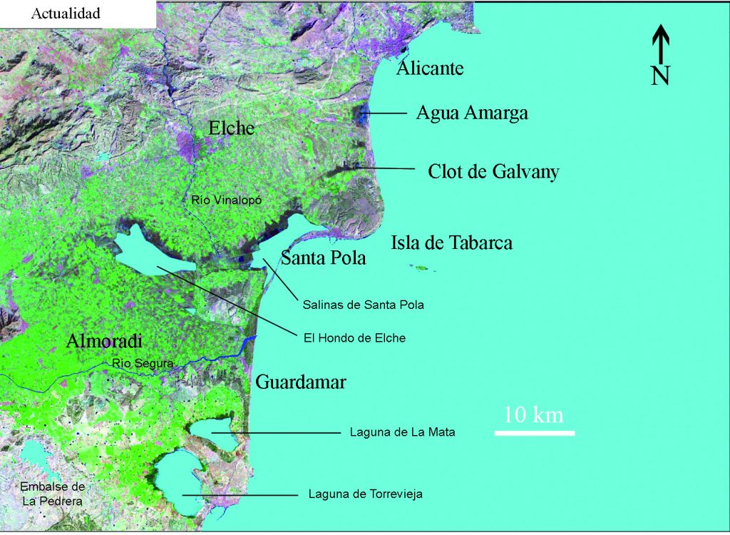
The development of the sinus illicitanus (II)
Change on the coastline of the Southern Alicante region
Tent-Manclús, J. E.
The Bajo Segura Region is a plain dominated by the Segura River with the mouth towards the Mediterranean Sea on Guardamar. The Hondón and Salinas de Santa Pola lagoons inside the plain, are the remains of a major marine bay known in the Roman times as the sinus ilicitanus. Offshore the Region geophysical data has permitted to model the coastline change and study the underwater marine terraces. 183 maps have been made from the 15000 BP until Today (100 year apart the older ones and 25 years for the recent ones). The coastline has migrated between 20 and 50 km onshore and then offshore about tens of meters to 35 km shaping today coastline. The sea level at 15000 BP was located 70 m below today sea-level (btsl). During the Younger Dryas (13500 to 11700 BP) varies around 60-66 m btsl then increase until 21 m btsl and stopped during the 8.2 ka event (8500 BP to 8200 BP). Again, the level increases first fast and then slowly but moving fast horizontally (near 35 km for 1000 years) developing the sinus ilicitanus when the marine transgression enters the plain about 4200 BC. The Segura River developed a delta in the today area of Orihuela, 35 km to the East of its today river mouth in Guardamar. The river until around the year 1400 AD developed a fingering (bird-foot) quite variable delta in the center of the sinus, most of the major irrigation canals (acequias) could correspond to the ancient delta-channels. Around the XV century major events changed the sinus basin producing the river mouth move to the present location. The sinus open communication with the Mediterranean Sea was closed around the XVIII century by sand bars, first the southern of Guardamar and then the northern on Santa Pola.
Cite as:
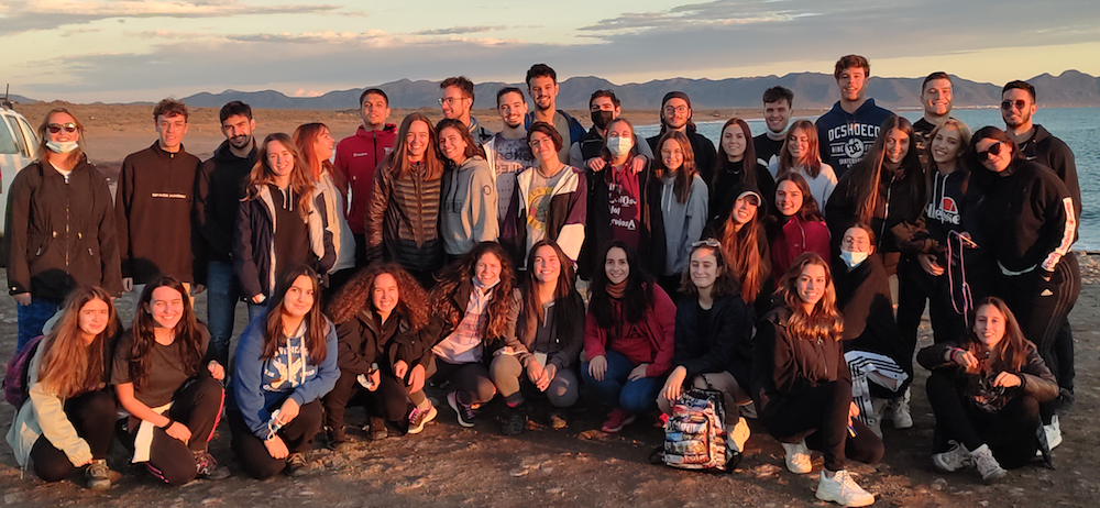
Marine Geology field trip to Sorbas (post-pandemic)
This year the students of the third course of Marine sciences of the Alicante University, could not go for a field trip on November as previous years, visiting the Sorbas basin, Cabo de Gata, and Hoyazo de Nijar. When the courses ended on May most of the students did the visit. The visit took place on 27 and 28 of May of 2021.
The field trip was strange because of the new normality and also the rain comes to Almeria during the visit.
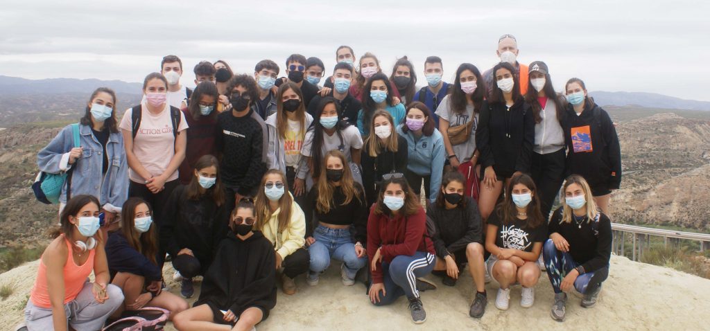
The professors in charge were Juana Jordá, and José Enrique Tent-Manclús.
Recent Comments