Students of the third course of the Alicante University Geology Degree visit the Laboratorio Marino de Denia and the Denia Harbour on April 15 th of 2026. The student pilot the ROV, navigated with the éfira boat, using the side-scan-sonar and the Van Veen dredge.
Tags: Alicante University, Geophysics, Laboratorio Marino-Denia, ROV
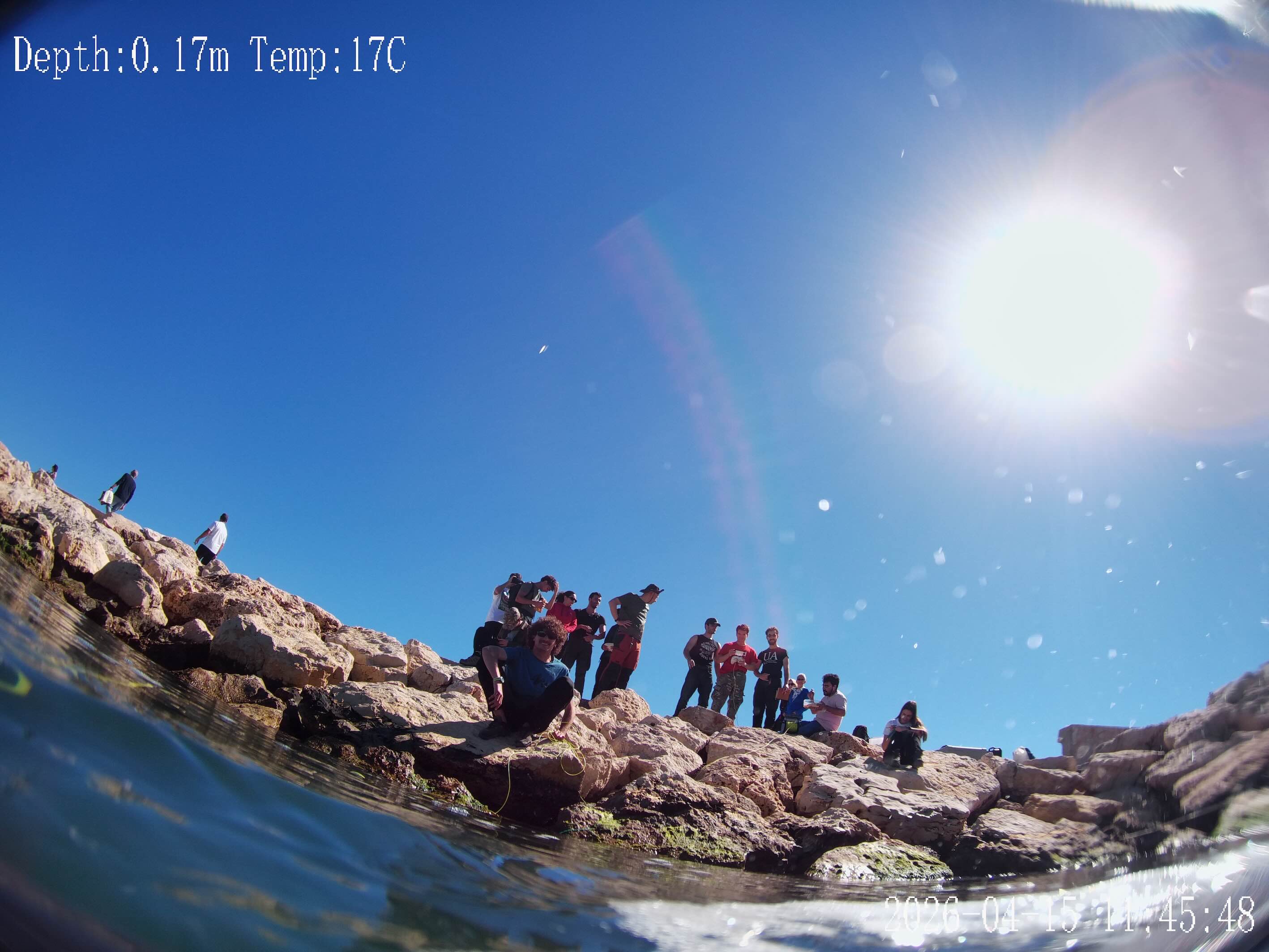
Students of the first course of the Alicante University Geology Degree visit the Cala del Moraig section and the Riu Blanc marine spring in El Poble Nou de Benitatxell (Alicante) on February 13 th of 2026.
Geology II. Thermal image with Ironed palette.
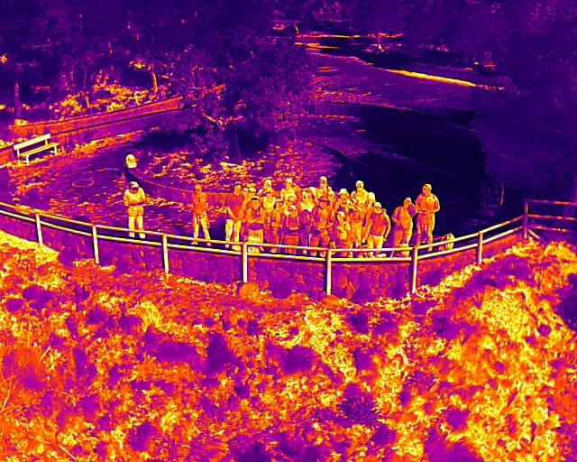
Students of the third course of Marine sciences of the Alicante University visit the Sorbas basin on October 30th of 2025.
The drone picture show the student in Sorbas (Almeria).
In the 17th century, Gaspar Escolano made a description of the coasts of the Kingdom of Valencia. He describes different sources of fresh water along the coast. In Peñiscola (Province of Castellon), he mentions a source near where the waves break that became saline and then returned to fresh water, being one of the first documented mentions of coastal salinization and its reversal. In the province of Valencia, the Albufera was a lagoon of sea water connected to the sea that had fresh water springs, used by fishermen. Today, some springs called “ullals” are still active and already pour into a coastal lagoon of fresh water. Finally, in Alicante, he mentions the Agua Dulce
cove in Denia and the sandbank of Rio Seco, while he describes the important coastal spring of the Morro de Toix cliff, now mainly inactive. This information from 400 years ago allows us to know the coasts before the great anthropic modification of the 20th century.
Cite as: Tent-Manclús, J. E., Bonomo, D., Jordá, J. D., Navarro Pedreño, J. y Jordán, M. M. (2025). Las surgencias de agua dulce en la costa de la Comunidad Valenciana (España) a partir de la descripción de la costa de Gaspar Escolano (siglo XVII). Geogaceta, 78: 39-42.https://sge.usal.es/archivos/geogacetas/geo78/geo78_p_35_38.pdf
Tags: Escolano, marina springs, XVII Century
Students of the third course of Geology of the Alicante University visit the Albufera of Valencia on February 13th of 2025. The field trip was in the subject of Geophysics and Geophysical interpretation. We use the channels in the Albufera for test the side scan sonar and the ROV. Also, student learned firsthand how to conduct a manual borehole survey.
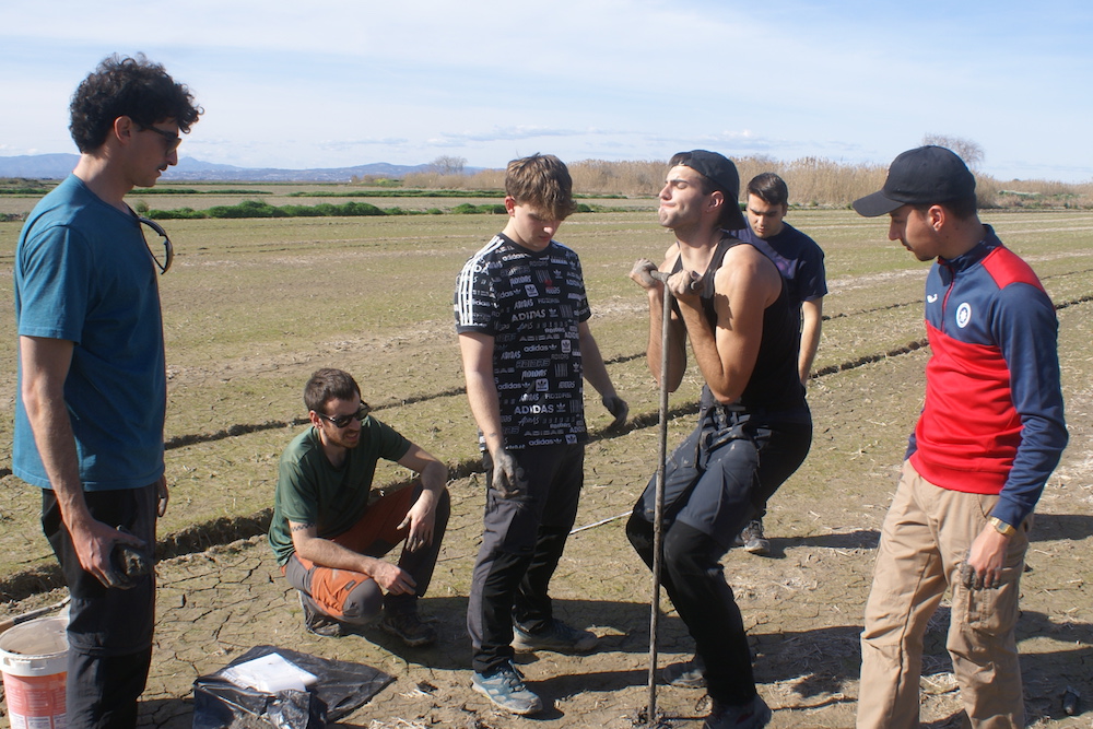
Students recovering the manual borehole sample in Sueca (Valencia) .
The professors of the subject were David Bonomo, and José Enrique Tent-Manclús.
Tags: Albufera, Geology degree, Geophysics
The calcareous nannofossils of the genus Ceratolithus, known for their horseshoe shape (referred to as ceratolith), evolved from the Orthorhabdus rugosus, a rod-shape nannolith with three rodded blades (sinistral, median, and dextral). The sinistral and median blades gave rise to the sinistral and dextral arms of the ceratolith, while the dextral blade was reduced to a keel. The first species of the Ceratolithus genus branch is Ceratolithus finifer, which rapidly evolved into Ceratolithus acutus. Around at the same time, the merging of three duplicated, delicate horseshoe-shaped structures derived from C. finifer – two equivalent and one a mirror image of the other- resulted in the short-lived Poralithus atlanticus (5.32 to 5.17 Ma). Later on, two duplicated horseshoe-shaped structures oriented at an angle of approximately 45° and fused at the horseshoe’s close side, produced Amaurolithus tricorniculatus (5.30 to 4.86 Ma). The crystallographic features of A. tricorniculatus points to a possible origin by two duplicated Ceratolithus-type horseshoes (birefringent in its stable layout) and derived from C. finifer. Being the type species of the Amaurolithus genus and also evolving from the Ceratolithus branch, then the early ‘Amaurolithus’, which evolved from O. rugosus, have been placed in a newly defined Protoamaurolithus genus, as Protoamaurolithus primus and Protoamaurolithus delicatus. Best-preserved Amaurolithus tricorniculatus specimens are observed to show birefringence and the broken and poor-preserved use to be slightly or not birefringence. Poralithus atlanticus and Amaurolithus tricorniculatus appeared instantly in the geologic record, indicative of instantaneous speciation, resulting from horseshoe-structure duplication process.
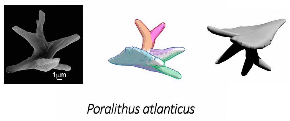
Figure. 3D recreation of Poralithus atlanticus.
Cite as: Lancis, C., Tent-Manclús, J. E., Lancis, J., Estévez, A. y Flores, J. A. (2025): Evolution of Neogene fossil ceratoliths (Coccolithophores) by duplication. Marine Micropaleontology, Volume 201, 102530.
https://doi.org/10.1016/j.marmicro.2025.102530
Tags: Amaurolithus tricorniculatus, Duplication, Early Pliocene, Nannofossils evolution, Poralithus atlanticus, Protoamaurolithus
Huerta Cape is an urban rocky coast with coves on the city of Alicante coast (SE Spain), between the San Juan beach to the North and the Albufereta beach to the West. This microtidal coast has a 30-cm tidal amplitude. The basement is made of latest Tortonian 20º- north dipping sandstones covered by flat-laying Tyrrhenian beach microconglomerate with Tethystrombus latus and other Senegalese fauna (MIS 5e, about 120 ka). About 25 UAV (Unmanned Aerial Vehicle)/drone flights have been made on the south Alicante beaches at different flight heights and times of the day, always with appropriate weather conditions, near no-waves flat sea surface, to obtain the best adjustment of sunlight reflection to avoid sunglint and capture the best view of the sea bottom. The flights were designed with the application Dronelink for fast and reproducible flights. The best result was in the wintertime, middle of the morning, and 40 -m-high flights, producing a set of 11 good quality drone flights, a total of 3435 azimuthal photographs were taken. Each flight was processed separately using different photogrammetric software with variable settings to find the best procedure. The best individual 3D models were obtained with the WebODM software. Then flights were grouped in two sets, one with 4 flights corresponding to 1239 valid pictures, and the other 7 flights with 2002 valid pictures. The two 3D models show 2 underwater erosion platforms plus today’s forming vermetid -rimmed platform. It can also be mapped in many blocks, some underwater and others in the foreshore. The fractures could be followed underwater to a depth of about 5 m and the Tyrrhenian level beach microconglomerate could be mapped underwater. Finally, the underwater rocky bottom outcrops are found aligned, producing sandy bottom bands in the slightly eroded levels, whereas bands of Posidonia oceanica could be clearly distinguished in the rocky elevations. This methodology makes it fast and easy to monitor the coastal dynamics until the 3 to 5 m depth where the side scan sonar surveys fail or decrease the quality of the data.
Cite as: Tent-Manclús, J. E. y Bonomo, D. (2025). Using an UAV/drone to map underwater rocky coast (Huerta Cape, Alicante, SE Spain). In: Morales, J. A., Carro, B. M., Cantero, C. y Amador-Luna, D. (Eds.). Sedimentology on the estuary shore 38th IAS Meeting Huelva-Spain, 26-28 June 2025. 304.
Tags: Alicante, erosion platform, Rocky Coast
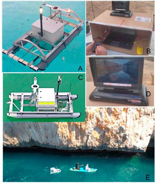
A) Self-developed USV (Unmanned Surface Vehicle) in development phase I, with position, starboard and port side lights and GPS tracker. B) Custom control working station. C) USV development phase II, the platform has been improved with a submerged and a frontal camera (to the right) plus two antennas, one for amplify the RC communication signal and the other for real time video broadcast. D) Real time video display of one-at-time cameras installed on USV. E) USV man-powered example in a Side Scan Scan survey of a sea-cliff.
cite as: Benabdeloued, B. Y. N., Ronda, J. L., Bonomo, D., Tent-Manclús, J. E., 2025. Low-cost unmanned surface vehiche: Development and Applicantions. In: Furlani, S., Devoto, S., Pappalardo, M., Gomez-Pujol, L. y Strelecki, M. (Eds.). International Rock Coast Conference 2025. A state of the art, Trieste Italia, 25-26 June 2025. 26-27 p.
Tags: Rocky Coast, University Alicante
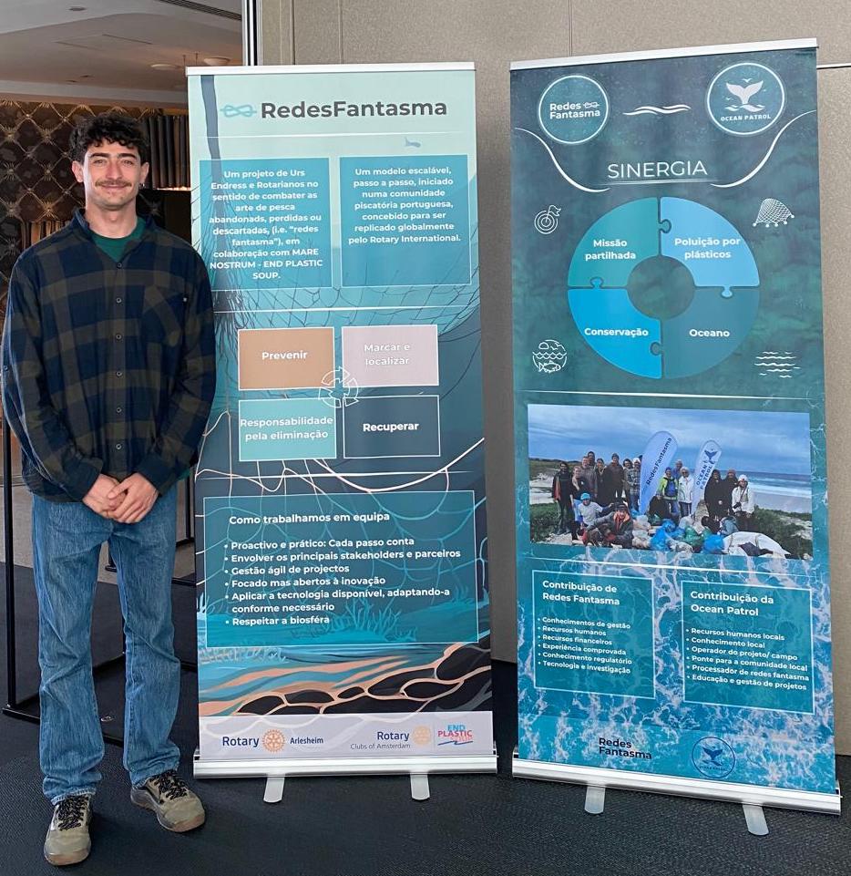
The Redes Fantasma is a symposium about lost marine trawls, to mark and to try to recover them held in Peniche (Portugal) on March 20th 2025. It was organized by the Rotary Club Atlantico Região Oeste D1960 with collaboration in the organization of NGO Ocean Patrol.
Our Ph D student Davide Bonomo was participating with an speak about Side Scan Sonar.
Tags: Side Scan Sonar
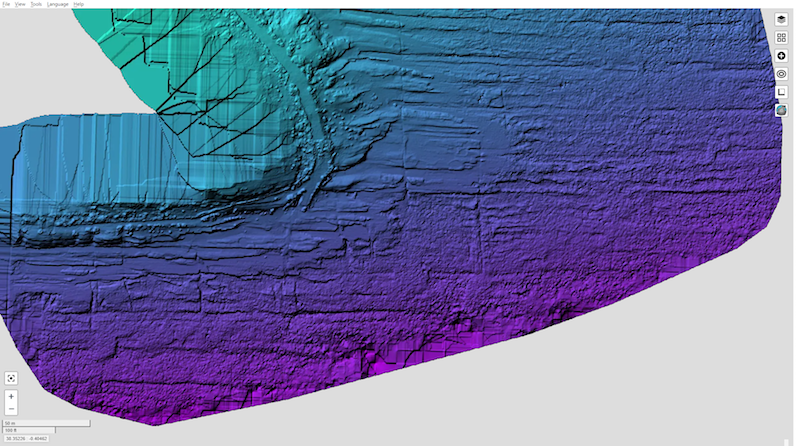
The Morro de Toix seacliff, located South of Calpe, on the Alicante coast in southeastern Spain, is a 70 to 30 m high seacliff. The western portion is plane and eastern portion of the seacliff is highly karstified and overhanging. The foot is currently submerged. An USV (Unmanned Surface Vessel) platform adapted to be towed by a manned vehicle, a paddle surfboard, has been used, with the aim of studying the geomorphology of the underwater part. To study the submerged bottom of the cliff, an USV (Unmmaned Surface Vessel) platform has been used. It has been adapted to be towed by a crewed vehicle, a paddle surfboard. This is an easy and fast procedure when a short excellent weather conditions windows is found obtaining good side scan sonar, single beam and downscan data. The result of the processed data has shown a metric-blocky seabed near the cliff and the underwater cliff is excavated around 3-4 m in the western portion and irregulary excavated in the eastern part with many cove and caves.

cite as: Bonomo, D., Ronda, J. L., Benabdeloued, B. Y. N., Tent-Manclús, J. E., Salcedo-Justicia, E. M. y Alcántara-Carrió, J. (2024): Estudio con sonar de barrido lateral de la base del acantilado del Morro de Toix (Calpe, Alicante). In: Palomar Vazquez, J. y Pardo Pascual, J. (Eds.). GEOLIT24 – Libro de Actas – XII Jornadas de Geomorfología Litoral. 25-27 de septiembre de 2024. Valencia. 254-259. https://doi.org/10.4995/GEOLIT24.2024.18726
Tags: Calpe, Morro de Toix, Seacliff
Recent Comments