The change of the coastline in the southern part of the province of Alicante for the last 15,000 years have been modeled and described in the work of Tent-Manclus (2013). It is obtained by integrating data from different sources and especially high-resolution seismic profiles of the nearby marine continental shelf. Ten periods have been distinguished in the evolution of the Bajo Segura coastline : 1) 15000 BP- 14600 BP: rapid rise; 2) 14600 BP to 13500 BP: the Older Dryas, slow rise; 3) 13500 BP to 12700 BP: stability and descent; 4) 12700 BP to 11700 BP: the Younger Dryas, descent of the sea level; 5) 11700 BP to 11300 BP: very fast rise; 6) 11300 BP a 8500 BP: rapid rise; 7) 8500 BP = 6500 AC to 8200 BP = 6200 AC: 8.2 ka event stabilization; 8) 6,200 BC to 4,000 BC: rise, Tabarca Island is form; 9) 4000 BC to 3000 BC: the slow rise due to subsidence sinus ilicitanus forms and 10) 3000 BC to the present day 2000 AD: the sinus ilicitanus desiccates.
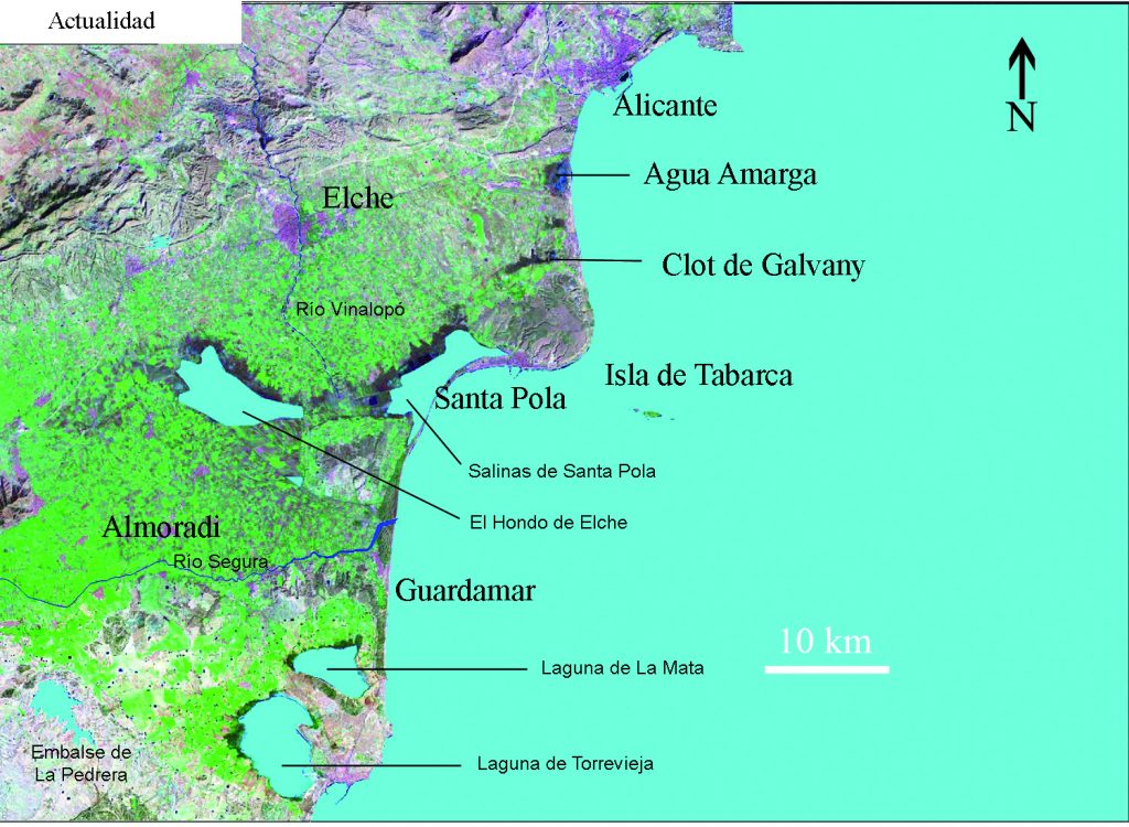
Map of the southern Alicante coast area used in the work
Maps at different times are show selected from the 164 maps that have been made. This is a first version of how the coastline evolves in the region. This work It can be a starting point to improve knowledge of the historical landscape evolution..
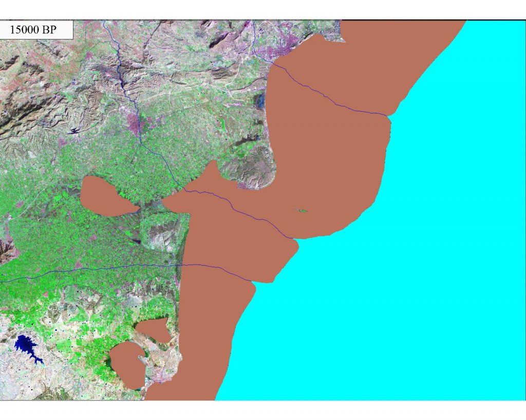
Map of the South Alicante coast 15000 BP. The sea level was 70 m below today level. The rivers Vinalopo and Segura were running parallel.
The sinus ilicitanus dries until today, the rest of which are the lagoons of the Fondo and Santa Polo Salinas.
Cite as: Tent-Manclús, J. E. (2013): Cambios de la línea de costa en el Bajo Segura (S de Alicante) en los últimos 15.000 años. Estudios geográficos, 74 (275): 684-702. Doi: 10.3989/estgeogr.201324
Tags: Alicante coast, Bajo Segura, coastal maps, Holocene, sea-level change