Home » 2022
Yearly Archives: 2022
Historical Earthquakes in Valencia
The “1396 Tabernes” earthquake occurred in the Valldigna valley and it has been considered one of the largest Iberian Peninsula recorded earthquakes. The information used for such claims has always been from secondary sources in the area because the originals were believed to be lost. In this work, the recently edited copy of the book about the Royal Monastery Nuestra Señora de la Valldigna history, the “Chronological history” of Father Estevan Gil, has permitted to correct the date of December 16th instead of December 18thfor the main earthquake. The earthquake damage is reinterpreted from the original source. In addition, the importance of the November 7th 1330 earthquake which represents the first destruction of the monastery, is pointed out. The original book provides information on the last destruction of the church in the 1644 earthquake, its damage and reconstruction. Together with another book, also recently published by Tomás Gómez, on the castilian visit of 1666, it allows us to discover what the monastery was like and understand the damage and reconstruction. Finally, two other earthquakes are mentioned in the years 1724 and 1748 that are also reflected in Father Gil’s book.
Cite as: Tent-Manclús, J. E. (2022): Los terremotos del sur de la provincia de Valencia según las fuentes del Real Monasterio de Nuestra Señora de la Valldigna (E de España, Provincia de Valencia). Cuaternario y Geomorfología, 36 (1-2): 77-103. https://doi.org/10.17735/cyg.v36i1-2.91108
K-nearest neighbors algorithm used for classifying geological variables.
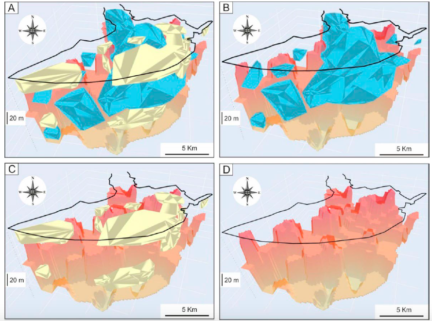
The k-nearest neighbors (KNN) algorithm is a non-parametric supervised machine learning classifier; which uses proximity and similarity to make classifications or predictions about the grouping of an individual data point. This ability makes the KNN algorithm ideal for classifying datasets of geological variables and parameters prior to 3D visualization. This paper introduces a machine learning KNN algorithm and Python libraries for visualizing the 3D stratigraphic architecture of sedimentary porous media in the Quaternary onshore Llobregat River Delta (LRD) in northeastern Spain. A first HTML model showed a consecutive 5 m-equispaced set of horizontal sections of the granulometry classes created with the KNN algorithm from 0 to 120 m below sea level in the onshore LRD. A second HTML model showed the 3D mapping of the main Quaternary gravel and coarse sand sedimentary bodies (lithosomes) and the basement (Pliocene and older rocks) top surface created with Python libraries. These results reproduce well the complex sedimentary structure of the LRD reported in recent scientific publications and proves the suitability of the KNN algorithm and Python libraries for visualizing the 3D stratigraphic structure of sedimentary porous media, which is a crucial stage in making decisions in different environmental and economic geology disciplines.
Interactive figures here
Santiago Moliner Aznar Ph D. Thesis
Santiago Moliner Aznar defended the Ph. D. Thesis “Caracterización y valorización del patrimonio geológico del área de Sierra Espuña (Cordillera Bética: SE, España” on April 27th 2022.
Abstract:
The Sierra Espuña area (Murcia: SE Spain) is characterized by their great biodiversity integrated in the Intercontinental Biosphere Reserve of the Mediterranean. Although authorities are very interested in valorization and protection of biodiversity (flora and fauna), the interest in geological heritage is still much lower. So, this PH Thesis tries to show and give value to the very best sites of geologic interest recognizable in the area (Sierra Espuña and the Mula-Pliego-Gebas Depression). So, 55 sites have been proposed as suitable to be considered as geological heritage. The characterization of these sites is done through an approach of combination of recent methods practiced and published. The methodology allows the identification of general data, physical description, evaluation of scientific value (SV), the Potential Educational Use (PEU), Potential Tourism Use (PTU) and the Degradation Risk (DR). The use of the quantification methodology (Brilha, 2016) confirmed that the sites of the Regional Park of Sierra Espuña are of international relevance with a solid and objective inventory. Similarly, the results of the valorization indicate that 51 sites have high or very high scientific value, while all the sites reach high or very high didactic and touristic values. Contrarily, the degradational risk is mostly low or moderate. Only 19 sites show high or very high values. The inventoried sites are distributed over Sierra Espuña Regional Park and neighboring areas (Mula-Pliego-Gebas Depression), being located along pedestrian paths, trails, tracks and motorways. These sites present a wide variety of geological typologies such as structural geology, stratigraphy, sedimentology, paleontology, geomaterials, petrology, geomorphology, hydraulic and hydrogeology. The valuation of the selected geosites led us to their distribution and integration in 8georoutes (El Berro, with 8 sites; Las Alquerías, with 7 sites; Cumbres Espuña, with 7 sites; Valle de Malvariche, with 9 sites; Aledo-La Santa, with 5 sites; Pliego Depression, with 6 sites; Paraje de Gebas, with 7 sites; Mula, with 6 sites). Finally, some actions following the criteria of the Global Geoparks Network by UNESCO have been proposed for the better conservation of the geosites but also to contribute to education and to promote tourism. These actions would also stimulate economic activity and sustainable development in the area by attracting increasing numbers of visitors interested in the geological heritage.
A Python Application for Visualizing the 3D Stratigraphic Architecture
A Python application for visualizing the 3D stratigraphic architecture of porous sedimentary media has been developed. The application uses the parameter granulometry deduced from borehole lithological records to create interactive 3D HTML models of essential stratigraphic elements.
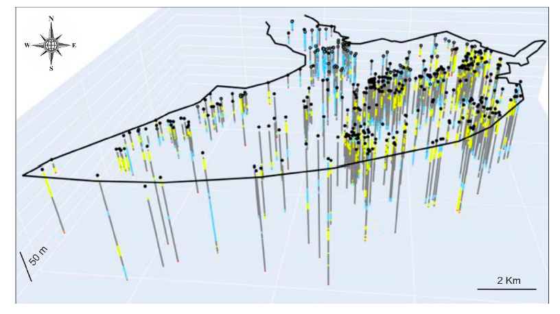
On the basis of the high density of boreholes and the subsequent geological knowledge gained during the last six decades, the Quaternary onshore Llobregat River Delta in northeastern Spain was selected to show the application. The public granulometry dataset produced by the Water Authority of Catalonia from 433 boreholes in this strategic coastal groundwater body was clustered into the clay–silt, coarse sand, and gravel classes. Three interactive 3D HTML models were created. The first shows the location of the boreholes granulometry. The second includes the main gravel and coarse sand sedimentary bodies (lithosomes) associated with the identified three stratigraphic intervals, called lower (>50 m b.s.l.) in the distal Llobregat Delta sector, middle (20–50 m b.s.l.) in the central Llobregat, and upper (<20mb.s.l.) spread over the entire Llobregat. The third deals with the basement (Pliocene and older rocks) top surface, which shows an overall steeped shape deepening toward the marine platform and local horsts, probably due to faulting. The modeled stratigraphic elements match well with the sedimentary structures reported in recent scientific publications.
This proves the good performance of this incipient Python application for visualizing the 3D stratigraphic architecture, which is a crucial stage for groundwater management and governance.
Field work in the Eocene Prebetic II
The rain in Spain…
Well the second field work campaign in the Eocene Prebetic was conditional by the bad weather, rain, wind, snow and cold.
The picture shows the members of the team imply in this field try to the Eocene rocks within the provinces of Alicante and Murcia.
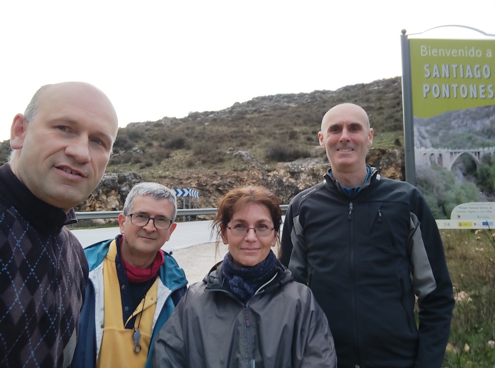
This is the second field season of the project of the Spanish research agency (Agencia Estatal de Investigación) of the Spanish Science and innovation minister (Ministerio de Ciencia e Innovación) entitle as “EVOLUCION TECTONO-DEPOSICIONAL DE CUENCAS SEDIMENTARIAS CENOZOICAS: CARACTERIZACION 2D-3D Y MEJORA DE PATRONES ESTANDAR” (PID2020-114381GB-I00). See previous post.
Sierra Espuña Malaguide an example of geological heritage
The Cenozoic Malaguide Basin from Sierra Espuña (Internal Betic Zone, S Spain) due to the quality of outcropping, areal representation, and continuity in the sedimentation can be considered a key-basin. In the last 30 years, a large number of studies with very different methodological approaches have been done in the area. Models indicate an evolution from passive margin to wedgetop basin from Late Cretaceous to Early Miocene. Sedimentation changes from limestone platforms with scarce terrigenous inputs, during the Paleocene to Early Oligocene, to the deep basin with huge supplies of turbidite sandstones and conglomerates during the Late Oligocene to Early Miocene. The area now appears structured as an antiformal stack with evidence of synsedimentary tectonics. The Cenozoic tectono-sedimentary basin evolution is related to three phases: (1) flexural tectonics during most of the Paleogene times to create the basin; (2) fault and fold compartmentation of the basin with the creation of structural highs and subsiding areas related to blind-fault-propagation folds, deforming the basin from south to north during Late Oligocene to Early Aquitanian times; (3) thin-skin thrusting tectonics when the basin began to be eroded during the Late Aquitanian-Burdigalian. In recent times some works on the geological heritage of the area have been performed trying to diffuse different geological aspects of the sector to the general public. A review of the studies performed and the revisiting of the area allow proposing different key-outcrops to follow the tectono-sedimentary evolution of the Cenozoic basin from this area. Eight sites of geological interest have been selected (Cretaceous-Cenozoic boundary, Paleocene Mula Fm, Lower Eocene Espuña- Valdelaparra Fms, Middle Eocene Malvariche-Cánovas Fms, Lowermost Oligocene As Fm, Upper Oligocene-Lower Aquitanian Bosque Fm, Upper Oligocene-Aquitanian Río Pliego Fm, Burdigalian El Niño Fm) and an evaluation has been performed to obtain four parameters: the scientific value, the educational and touristic potential, and the degradation risk. The firsts three parameters obtained values above 50 being considered of “high” or “very high” interest (“very high” in most of the cases). The last parameter shows always values below 50 indicating a “moderate” or “low” risk of degradation. The obtained values allow us considering the tectono-sedimentary evolution of this basin worthy of being proposed as a geological heritage.
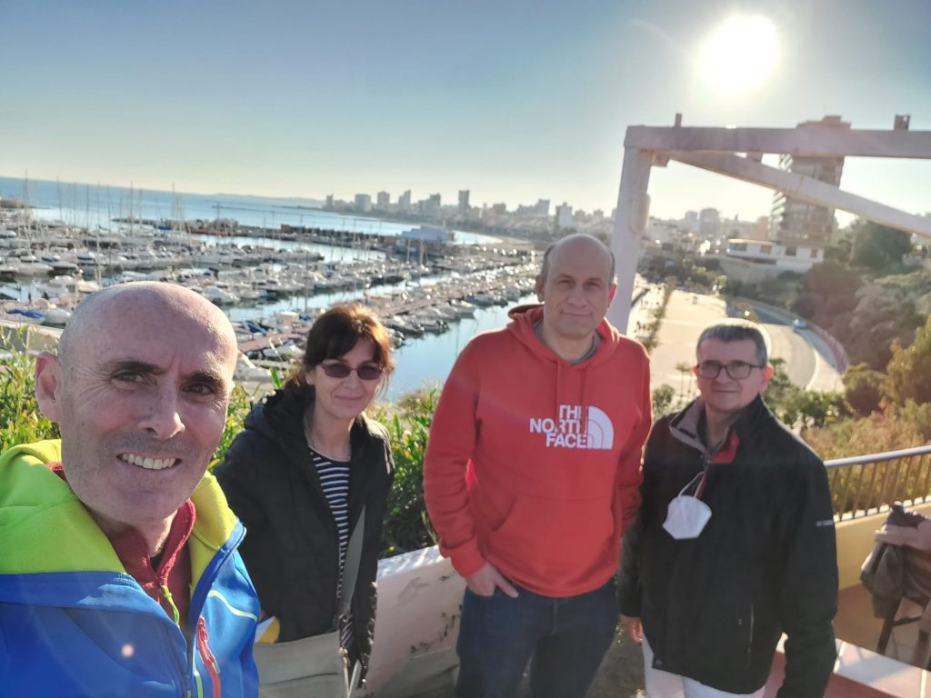
Field work in the Eocene Prebetic
The good weather in Alicante during the winter season has permitted to do the first field season of our project of the Spanish research agency (Agencia Estatal de Investigación) of the Spanish Science and innovation minister (Ministerio de Ciencia e Innovación) entitle as “EVOLUCION TECTONO-DEPOSICIONAL DE CUENCAS SEDIMENTARIAS CENOZOICAS: CARACTERIZACION 2D-3D Y MEJORA DE PATRONES ESTANDAR” (PID2020-114381GB-I00). See previous post.
The picture shows the members of the team imply in this field try to the Eocene rocks within the provinces of Alicante and Murcia.
Crina Miclaus (Alexandru Ioan Cuza University)
Josep Tosquella (Huelva University)
Manuel Martin-Martin (Alicante University)
Jose Enrique Tent-Manclus (Alicante University)
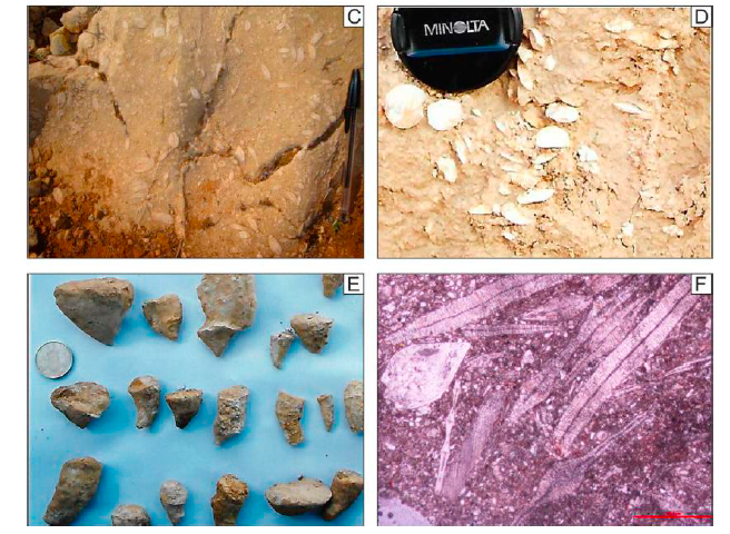
Next picture shows a nummulite-rich limestone in a quarry near Onil, one of the visited sections in our field work.

Recent Comments